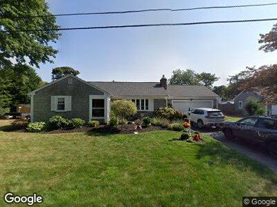
67 Brezner Ln Centerville, MA 02632
Centerville NeighborhoodEstimated Value: $609,452 - $696,000
3
Beds
2
Baths
1,501
Sq Ft
$436/Sq Ft
Est. Value
About This Home
This home is located at 67 Brezner Ln, Centerville, MA 02632 and is currently estimated at $654,863, approximately $436 per square foot. 67 Brezner Ln is a home located in Barnstable County with nearby schools including Centerville Elementary School, Barnstable United Elementary School, and Barnstable Intermediate School.
Ownership History
Date
Name
Owned For
Owner Type
Purchase Details
Closed on
Oct 3, 2017
Sold by
Conant John C and Conant Cynthia S
Bought by
Temple Jeffrey
Current Estimated Value
Home Financials for this Owner
Home Financials are based on the most recent Mortgage that was taken out on this home.
Original Mortgage
$184,000
Outstanding Balance
$158,300
Interest Rate
3.89%
Mortgage Type
New Conventional
Estimated Equity
$485,851
Purchase Details
Closed on
Mar 19, 2001
Sold by
Mary Concetta Derosa T
Bought by
Conant John C
Home Financials for this Owner
Home Financials are based on the most recent Mortgage that was taken out on this home.
Original Mortgage
$92,000
Interest Rate
7.01%
Mortgage Type
Purchase Money Mortgage
Create a Home Valuation Report for This Property
The Home Valuation Report is an in-depth analysis detailing your home's value as well as a comparison with similar homes in the area
Home Values in the Area
Average Home Value in this Area
Purchase History
| Date | Buyer | Sale Price | Title Company |
|---|---|---|---|
| Temple Jeffrey | $377,000 | -- | |
| Conant John C | $239,500 | -- |
Source: Public Records
Mortgage History
| Date | Status | Borrower | Loan Amount |
|---|---|---|---|
| Open | Temple Jeffrey | $184,000 | |
| Previous Owner | Conant John C | $225,000 | |
| Previous Owner | Conant John C | $89,000 | |
| Previous Owner | Conant John C | $92,000 |
Source: Public Records
Tax History Compared to Growth
Tax History
| Year | Tax Paid | Tax Assessment Tax Assessment Total Assessment is a certain percentage of the fair market value that is determined by local assessors to be the total taxable value of land and additions on the property. | Land | Improvement |
|---|---|---|---|---|
| 2025 | $4,645 | $574,200 | $168,700 | $405,500 |
| 2024 | $4,025 | $515,400 | $168,700 | $346,700 |
| 2023 | $3,931 | $471,300 | $166,700 | $304,600 |
| 2022 | $3,770 | $391,100 | $118,500 | $272,600 |
| 2021 | $3,603 | $343,500 | $118,500 | $225,000 |
| 2020 | $3,813 | $347,900 | $118,500 | $229,400 |
| 2019 | $3,666 | $325,000 | $118,500 | $206,500 |
| 2018 | $3,134 | $279,300 | $130,000 | $149,300 |
| 2017 | $2,934 | $272,700 | $130,000 | $142,700 |
| 2016 | $2,996 | $274,900 | $132,200 | $142,700 |
| 2015 | $2,881 | $265,500 | $126,100 | $139,400 |
Source: Public Records
Map
Nearby Homes
- 303 Phinney's Ln
- 64 Harrison Rd
- 122 Point of Pines Ave
- 429 Pine St
- 105 Annable Point Rd
- 65 Millstone Way
- 855 W Main St Unit 1
- 278 Riverview Ln
- 17 Cedar Point Cir
- 156 S Main St
- 14 Bee Ln
- 117 Pheasant Way
- 394 Old Stage Rd
- 344 Main St Unit 6
- 9 Pine Tree Dr
- 4 Waterside Dr
- 52 Meadow Farm Rd
- 395 Strawberry Hill Rd