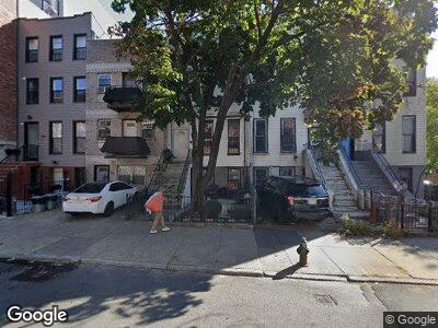
67 Lewis Ave Unit Building Brooklyn, NY 11206
Bed-Stuy NeighborhoodEstimated Value: $1,536,000 - $1,794,000
--
Bed
4
Baths
2,800
Sq Ft
$583/Sq Ft
Est. Value
About This Home
This home is located at 67 Lewis Ave Unit Building, Brooklyn, NY 11206 and is currently estimated at $1,631,333, approximately $582 per square foot. 67 Lewis Ave Unit Building is a home located in Kings County with nearby schools including P.S. 81 - Thaddeus Stevens, Bedford Stuyvesant New Beginnings Charter School, and The Brooklyn Charter School.
Ownership History
Date
Name
Owned For
Owner Type
Purchase Details
Closed on
Jan 27, 2000
Sold by
Boston Charles
Bought by
Curry John J
Current Estimated Value
Home Financials for this Owner
Home Financials are based on the most recent Mortgage that was taken out on this home.
Original Mortgage
$130,000
Interest Rate
8.23%
Purchase Details
Closed on
Oct 4, 1994
Sold by
Curry John J
Bought by
Boston Charles
Home Financials for this Owner
Home Financials are based on the most recent Mortgage that was taken out on this home.
Original Mortgage
$72,000
Interest Rate
8.49%
Create a Home Valuation Report for This Property
The Home Valuation Report is an in-depth analysis detailing your home's value as well as a comparison with similar homes in the area
Home Values in the Area
Average Home Value in this Area
Purchase History
| Date | Buyer | Sale Price | Title Company |
|---|---|---|---|
| Curry John J | -- | Stewart Title Insurance Co |
Source: Public Records
Mortgage History
| Date | Status | Borrower | Loan Amount |
|---|---|---|---|
| Previous Owner | Curry John J | $130,000 | |
| Previous Owner | Boston Charles | $72,000 |
Source: Public Records
Tax History Compared to Growth
Tax History
| Year | Tax Paid | Tax Assessment Tax Assessment Total Assessment is a certain percentage of the fair market value that is determined by local assessors to be the total taxable value of land and additions on the property. | Land | Improvement |
|---|---|---|---|---|
| 2024 | $1,111 | $88,740 | $17,400 | $71,340 |
| 2023 | $1,130 | $78,420 | $17,400 | $61,020 |
| 2022 | $1,099 | $73,440 | $17,400 | $56,040 |
| 2021 | $1,180 | $77,220 | $17,400 | $59,820 |
| 2020 | $885 | $64,620 | $17,400 | $47,220 |
| 2019 | $968 | $68,400 | $17,400 | $51,000 |
| 2018 | $837 | $14,680 | $4,720 | $9,960 |
| 2017 | $1,149 | $14,680 | $4,979 | $9,701 |
| 2016 | $835 | $14,565 | $5,949 | $8,616 |
| 2015 | $1,670 | $13,741 | $7,253 | $6,488 |
| 2014 | $1,670 | $12,964 | $8,074 | $4,890 |
Source: Public Records
Map
Nearby Homes
- 311 Hart St Unit 2AA
- 327 Vernon Ave
- 347 Pulaski St
- 841 Willoughby Ave
- 279 Hart St
- 974 Dekalb Ave
- 121 Lewis Ave
- 707 Willoughby Ave Unit 7-A
- 16 Melrose St Unit 1
- 18 Melrose St Unit 2
- 20 Melrose St Unit 2
- 420A Kosciuszko St
- 444 Pulaski St Unit 1
- 444 Pulaski St Unit 2F
- 935 Lafayette Ave Unit 3
- 935 Lafayette Ave Unit 1
- 867 Lafayette Ave
- 851 Lafayette Ave
- 918 Lafayette Ave
- 924 Lafayette Ave Unit 2