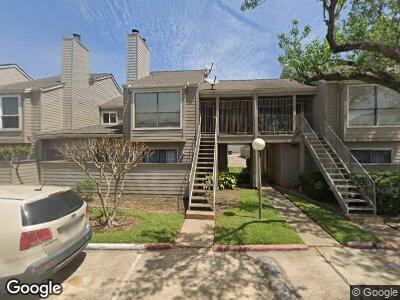
6701 Sands Point Dr Unit 41 Houston, TX 77074
Sharpstown NeighborhoodEstimated Value: $145,302 - $177,000
2
Beds
2
Baths
1,157
Sq Ft
$141/Sq Ft
Est. Value
About This Home
This home is located at 6701 Sands Point Dr Unit 41, Houston, TX 77074 and is currently estimated at $162,826, approximately $140 per square foot. 6701 Sands Point Dr Unit 41 is a home located in Harris County with nearby schools including Sutton Elementary School, Long Academy, and Wisdom High School.
Ownership History
Date
Name
Owned For
Owner Type
Purchase Details
Closed on
Aug 5, 2008
Sold by
Kaczmarek Anthony John and Kaczmarek Jennifer K
Bought by
Wells Fargo Bank Na
Current Estimated Value
Purchase Details
Closed on
Mar 20, 2008
Sold by
Navarrete Maria Teresa
Bought by
Gaona Arturo and Jimenez Angelica
Home Financials for this Owner
Home Financials are based on the most recent Mortgage that was taken out on this home.
Original Mortgage
$75,810
Interest Rate
5.72%
Mortgage Type
FHA
Purchase Details
Closed on
Jul 26, 2007
Sold by
Sandspoint West Condominiums & Assn Inc
Bought by
Navarrete Maria Teresa
Purchase Details
Closed on
Sep 22, 2006
Sold by
Hailey Roy D
Bought by
Sandspoint West Condominiums Assn Inc
Create a Home Valuation Report for This Property
The Home Valuation Report is an in-depth analysis detailing your home's value as well as a comparison with similar homes in the area
Home Values in the Area
Average Home Value in this Area
Purchase History
| Date | Buyer | Sale Price | Title Company |
|---|---|---|---|
| Wells Fargo Bank Na | $47,739 | None Available | |
| Gaona Arturo | -- | Smarter Title & Escrow Llc | |
| Navarrete Maria Teresa | -- | None Available | |
| Sandspoint West Condominiums Assn Inc | -- | None Available |
Source: Public Records
Mortgage History
| Date | Status | Borrower | Loan Amount |
|---|---|---|---|
| Previous Owner | Gaona Arturo | $75,810 |
Source: Public Records
Tax History Compared to Growth
Tax History
| Year | Tax Paid | Tax Assessment Tax Assessment Total Assessment is a certain percentage of the fair market value that is determined by local assessors to be the total taxable value of land and additions on the property. | Land | Improvement |
|---|---|---|---|---|
| 2023 | $2,254 | $157,543 | $29,933 | $127,610 |
| 2022 | $2,691 | $117,907 | $22,402 | $95,505 |
| 2021 | $2,089 | $89,642 | $17,032 | $72,610 |
| 2020 | $2,242 | $89,642 | $17,032 | $72,610 |
| 2019 | $2,160 | $82,762 | $15,725 | $67,037 |
| 2018 | $1,738 | $82,762 | $15,725 | $67,037 |
| 2017 | $1,994 | $82,762 | $15,725 | $67,037 |
| 2016 | $1,813 | $74,029 | $14,066 | $59,963 |
| 2015 | $1,251 | $63,174 | $12,003 | $51,171 |
| 2014 | $1,251 | $57,833 | $10,988 | $46,845 |
Source: Public Records
Map
Nearby Homes
- 6701 Sands Point Dr Unit 129
- 6701 Sands Point Dr Unit 109
- 6701 Sands Point Dr Unit 34
- 6701 Sands Point Dr Unit 23
- 6601 Sands Point Dr Unit 47
- 6601 Sands Point Dr Unit 44
- 6606 De Moss Dr Unit 1701
- 6606 De Moss Dr Unit 906
- 6500 Sands Point Dr Unit 201
- 6837 Bellaire Blvd
- 6857 Bellaire Blvd
- 7106 Harmony Cove
- 6405 Westward St Unit 96
- 6231 Westward St Unit 20
- 6609 Scribner Rd
- 6305 Westward St Unit 106
- 6305 Westward St Unit 160
- 7007 Bellaire Blvd
- 7200 Clarewood Dr Unit 511
- 7200 Clarewood Dr Unit 702