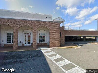
6715 Commerce St Springfield, VA 22150
Springtown NeighborhoodEstimated Value: $6,917,932
--
Bed
--
Bath
49,137
Sq Ft
$141/Sq Ft
Est. Value
About This Home
This home is located at 6715 Commerce St, Springfield, VA 22150 and is currently estimated at $6,917,932, approximately $140 per square foot. 6715 Commerce St is a home located in Fairfax County with nearby schools including Springfield Estates Elementary School, Key Middle, and Lewis High School.
Ownership History
Date
Name
Owned For
Owner Type
Purchase Details
Closed on
Dec 19, 2002
Sold by
Toys R Us Delaware Inc
Bought by
Commerce Springfield Llc
Current Estimated Value
Create a Home Valuation Report for This Property
The Home Valuation Report is an in-depth analysis detailing your home's value as well as a comparison with similar homes in the area
Home Values in the Area
Average Home Value in this Area
Purchase History
| Date | Buyer | Sale Price | Title Company |
|---|---|---|---|
| Commerce Springfield Llc | $3,025,000 | -- |
Source: Public Records
Mortgage History
| Date | Status | Borrower | Loan Amount |
|---|---|---|---|
| Open | Waterford At Springfield Llc | $1,500,000 | |
| Open | Commerce Springfield Llc | $5,500,000 | |
| Closed | Commerce Springfield Llc | $3,000,000 |
Source: Public Records
Tax History Compared to Growth
Tax History
| Year | Tax Paid | Tax Assessment Tax Assessment Total Assessment is a certain percentage of the fair market value that is determined by local assessors to be the total taxable value of land and additions on the property. | Land | Improvement |
|---|---|---|---|---|
| 2024 | $96,421 | $7,512,330 | $3,136,060 | $4,376,270 |
| 2023 | $86,061 | $6,865,660 | $3,136,060 | $3,729,600 |
| 2022 | $57,234 | $4,511,910 | $3,136,060 | $1,375,850 |
| 2021 | $101,565 | $7,821,720 | $3,136,060 | $4,685,660 |
| 2020 | $112,407 | $8,590,490 | $3,301,120 | $5,289,370 |
| 2019 | $116,828 | $8,928,360 | $2,971,010 | $5,957,350 |
| 2018 | $104,063 | $9,048,970 | $2,971,010 | $6,077,960 |
| 2017 | $118,623 | $9,224,210 | $2,971,010 | $6,253,200 |
| 2016 | $117,651 | $9,170,480 | $2,971,010 | $6,199,470 |
| 2015 | $114,674 | $9,240,430 | $2,971,010 | $6,269,420 |
| 2014 | $113,171 | $9,137,770 | $2,971,010 | $6,166,760 |
Source: Public Records
Map
Nearby Homes
- 6102 Fox Hill St
- 6430 Franconia Ct
- 6412 Franconia Ct
- 6613 Elder Ave
- 6001 Brandon Ave
- 6821 Floyd Ave
- 6944 Essex Ave
- 6610 Stagecoach St
- 6524 Greenleaf St
- 6400 Wayles St
- 7043 Calamo St
- 6430 Franconia Rd
- 6007 Waynesboro Cir
- 6522 Spring Rd
- 7203 Tanager St
- 6426 Meriwether Ln
- 6840 Clowser Ct
- 6015 Craig St
- 7204 Dormont St
- 6356 Demme Place