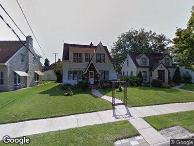
6715 W Grant St Milwaukee, WI 53219
East Allis NeighborhoodEstimated Value: $267,330 - $293,000
3
Beds
2
Baths
1,355
Sq Ft
$204/Sq Ft
Est. Value
About This Home
This home is located at 6715 W Grant St, Milwaukee, WI 53219 and is currently estimated at $276,833, approximately $204 per square foot. 6715 W Grant St is a home located in Milwaukee County with nearby schools including Jefferson Elementary School, Frank Lloyd Wright Intermediate School, and Central High School.
Ownership History
Date
Name
Owned For
Owner Type
Purchase Details
Closed on
Dec 29, 2004
Sold by
Cisewski Jennifer and Bautz Jennifer
Bought by
Lechner Ann M
Current Estimated Value
Home Financials for this Owner
Home Financials are based on the most recent Mortgage that was taken out on this home.
Original Mortgage
$132,000
Outstanding Balance
$70,608
Interest Rate
5.75%
Estimated Equity
$198,675
Purchase Details
Closed on
Jul 14, 1999
Sold by
Herrenbruck Todd R and Herrenbruck Rachael Ann
Bought by
Cisewski Jennifer
Home Financials for this Owner
Home Financials are based on the most recent Mortgage that was taken out on this home.
Original Mortgage
$96,800
Interest Rate
7.69%
Create a Home Valuation Report for This Property
The Home Valuation Report is an in-depth analysis detailing your home's value as well as a comparison with similar homes in the area
Home Values in the Area
Average Home Value in this Area
Purchase History
| Date | Buyer | Sale Price | Title Company |
|---|---|---|---|
| Lechner Ann M | $165,000 | -- | |
| Cisewski Jennifer | $121,000 | -- |
Source: Public Records
Mortgage History
| Date | Status | Borrower | Loan Amount |
|---|---|---|---|
| Closed | Lechner Ann M | $25,200 | |
| Open | Lechner Ann M | $132,000 | |
| Previous Owner | Cisewski Jennifer | $96,800 |
Source: Public Records
Tax History Compared to Growth
Tax History
| Year | Tax Paid | Tax Assessment Tax Assessment Total Assessment is a certain percentage of the fair market value that is determined by local assessors to be the total taxable value of land and additions on the property. | Land | Improvement |
|---|---|---|---|---|
| 2023 | $3,804 | $144,300 | $20,100 | $124,200 |
| 2022 | $3,834 | $144,300 | $20,100 | $124,200 |
| 2021 | $3,743 | $144,300 | $20,100 | $124,200 |
| 2020 | $3,812 | $144,300 | $20,100 | $124,200 |
| 2019 | $3,671 | $144,300 | $20,100 | $124,200 |
| 2018 | $4,243 | $144,300 | $20,100 | $124,200 |
| 2017 | $3,875 | $144,300 | $20,100 | $124,200 |
| 2016 | $3,754 | $144,300 | $20,100 | $124,200 |
| 2015 | $3,756 | $144,300 | $20,100 | $124,200 |
| 2014 | $3,748 | $144,300 | $20,100 | $124,200 |
Source: Public Records
Map
Nearby Homes
- 2206 S 70th St
- 2218 S 65th St
- 2209 S 64th St
- 6824 W Hayes Ave
- 2049 S 71st St
- 2402 S 64th St
- 1964 S 72nd St
- 6104 W Lincoln Ave
- 2474 S 70th St
- 2535 S 66th St
- 2525 S 70th St
- 6532 W Mitchell St
- 7500 W Lincoln Ave
- 2013 S 75th St
- 2153 S 58th St
- 1747 S 61st St
- 1728 S 73rd St
- 7113 W National Ave
- 2538 S 61st St
- 2416 S 59th St