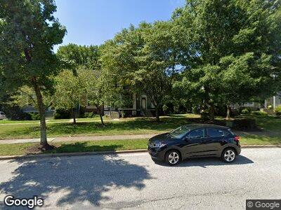
6721 Ammendale Way Beltsville, MD 20705
Konterra NeighborhoodEstimated Value: $346,088 - $424,000
4
Beds
3
Baths
1,320
Sq Ft
$291/Sq Ft
Est. Value
About This Home
This home is located at 6721 Ammendale Way, Beltsville, MD 20705 and is currently estimated at $383,522, approximately $290 per square foot. 6721 Ammendale Way is a home located in Prince George's County with nearby schools including Vansville Elementary School, Martin Luther King Jr. Middle School, and High Point High School.
Ownership History
Date
Name
Owned For
Owner Type
Purchase Details
Closed on
Sep 5, 2001
Sold by
Endres Brett M
Bought by
Sow Abubakar and Sow Fatimatu
Current Estimated Value
Purchase Details
Closed on
Aug 25, 1993
Sold by
Partello Ralph B
Bought by
Endres Brett M and Jennifer Jacob M
Purchase Details
Closed on
Jan 23, 1989
Sold by
Grice Todd A
Bought by
Partello Ralph B
Create a Home Valuation Report for This Property
The Home Valuation Report is an in-depth analysis detailing your home's value as well as a comparison with similar homes in the area
Home Values in the Area
Average Home Value in this Area
Purchase History
| Date | Buyer | Sale Price | Title Company |
|---|---|---|---|
| Sow Abubakar | $140,000 | -- | |
| Endres Brett M | $124,000 | -- | |
| Partello Ralph B | $128,500 | -- |
Source: Public Records
Mortgage History
| Date | Status | Borrower | Loan Amount |
|---|---|---|---|
| Open | Sow Abubakar | $210,000 | |
| Closed | Sow Abubakar | $85,000 | |
| Closed | Sow Fatimatu | $67,000 |
Source: Public Records
Tax History Compared to Growth
Tax History
| Year | Tax Paid | Tax Assessment Tax Assessment Total Assessment is a certain percentage of the fair market value that is determined by local assessors to be the total taxable value of land and additions on the property. | Land | Improvement |
|---|---|---|---|---|
| 2024 | $4,754 | $293,667 | $0 | $0 |
| 2023 | $4,557 | $280,433 | $0 | $0 |
| 2022 | $4,360 | $267,200 | $100,000 | $167,200 |
| 2021 | $4,222 | $257,900 | $0 | $0 |
| 2020 | $4,084 | $248,600 | $0 | $0 |
| 2019 | $3,945 | $239,300 | $100,000 | $139,300 |
| 2018 | $3,862 | $233,700 | $0 | $0 |
| 2017 | $3,779 | $228,100 | $0 | $0 |
| 2016 | -- | $222,500 | $0 | $0 |
| 2015 | $3,166 | $214,000 | $0 | $0 |
| 2014 | $3,166 | $205,500 | $0 | $0 |
Source: Public Records
Map
Nearby Homes
- 11431 Hawk Ridge Ct
- 11309 Broken Bow Ct
- 11777 Old Baltimore Pike
- 11505 Old Baltimore Pike
- Lots 48-49 Highview Ave
- Lots 44-47 Highview Ave
- 4915 Lincoln Ave
- 7603 Barkwood Ct
- 11714 Ellington Dr
- Lots 10,11 Rinard Ave
- 4913 Odell Rd
- 10644 Gross Ln
- Lots 48-50 Rinard Ave
- Lots 6,7 Rinard Ave
- Lots 28,29 Rinard Ave
- Lots 50-52 Rinard Ave
- 4901 Howard Ave
- 4811 Howard Ave
- Lots 45-47 Rinard Ave
- 4617 Olympia Ave
