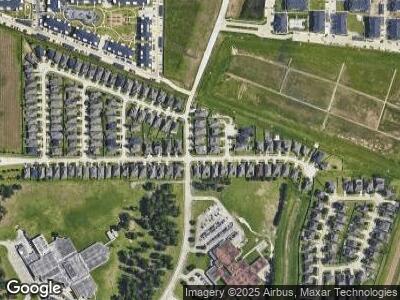
6902 New Forest Pkwy Houston, TX 77049
North Shore NeighborhoodEstimated Value: $295,000 - $302,853
4
Beds
3
Baths
2,189
Sq Ft
$136/Sq Ft
Est. Value
About This Home
This home is located at 6902 New Forest Pkwy, Houston, TX 77049 and is currently estimated at $298,463, approximately $136 per square foot. 6902 New Forest Pkwy is a home with nearby schools including Dr Shirley J Williamson Elementary School, Cobb 6th Grade Campus, and North Shore Middle School.
Ownership History
Date
Name
Owned For
Owner Type
Purchase Details
Closed on
Jun 24, 2015
Sold by
Mhi Partnership Ltd
Bought by
Harris Deborah L
Current Estimated Value
Home Financials for this Owner
Home Financials are based on the most recent Mortgage that was taken out on this home.
Original Mortgage
$253,360
Interest Rate
4.5%
Mortgage Type
FHA
Purchase Details
Closed on
Feb 26, 2013
Sold by
Fmr Land Holdings Llc
Bought by
Mhi Partnership Ltd
Purchase Details
Closed on
Oct 30, 2012
Sold by
New Forest West Section 4 Lp
Bought by
Fmr Land Holdings Llc
Create a Home Valuation Report for This Property
The Home Valuation Report is an in-depth analysis detailing your home's value as well as a comparison with similar homes in the area
Home Values in the Area
Average Home Value in this Area
Purchase History
| Date | Buyer | Sale Price | Title Company |
|---|---|---|---|
| Harris Deborah L | $253,360 | Millennium Title Co | |
| Mhi Partnership Ltd | -- | None Available | |
| Fmr Land Holdings Llc | -- | Millennum Title Houston |
Source: Public Records
Mortgage History
| Date | Status | Borrower | Loan Amount |
|---|---|---|---|
| Open | Harris Deborah L | $12,358 | |
| Open | Harris Deborah L | $243,581 | |
| Closed | Harris Deborah L | $247,180 | |
| Closed | Harris Deborah L | $253,360 | |
| Closed | Mhi Partnership Ltd | $0 |
Source: Public Records
Tax History Compared to Growth
Tax History
| Year | Tax Paid | Tax Assessment Tax Assessment Total Assessment is a certain percentage of the fair market value that is determined by local assessors to be the total taxable value of land and additions on the property. | Land | Improvement |
|---|---|---|---|---|
| 2023 | $2,852 | $341,419 | $55,493 | $285,926 |
| 2022 | $7,972 | $293,604 | $55,493 | $238,111 |
| 2021 | $8,097 | $275,472 | $55,493 | $219,979 |
| 2020 | $7,774 | $256,033 | $55,493 | $200,540 |
| 2019 | $7,938 | $249,788 | $55,493 | $194,295 |
| 2018 | $2,704 | $246,046 | $28,176 | $217,870 |
| 2017 | $7,876 | $246,046 | $28,176 | $217,870 |
| 2016 | $7,876 | $246,046 | $28,176 | $217,870 |
| 2015 | $680 | $28,176 | $28,176 | $0 |
| 2014 | $680 | $28,176 | $28,176 | $0 |
Source: Public Records
Map
Nearby Homes
- 14911 Hurst Point Ln
- 6723 Stableton Ln
- 14907 Havenvale Ln
- 14503 Brackenhurst Ln
- 6810 Latchmore Ln
- 14827 Fairy Tern Ln
- 0 E Sam Houston Pkwy N
- 6710 Russelfield Ln
- 6623 Surrey Meadow Ct
- 6614 Surrey Meadow Ct
- 15506 Satsuma Point Ct
- 14658 Flair Dr
- 13535 Wembley Heights Dr
- 14634 Edenglen Dr
- 13518 Wembley Heights Dr
- 14650 Dartwood Dr
- 6802 Oleander Grove Way
- 15602 Sweet Maple Ct
- 7519 Welsh Stone Ln
- 6551 Providence View Ln
