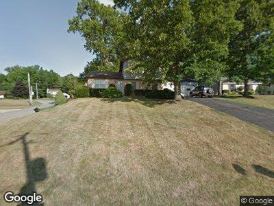
691 Regal Dr Youngstown, OH 44515
Austintown NeighborhoodEstimated Value: $190,000 - $209,000
3
Beds
2
Baths
1,488
Sq Ft
$137/Sq Ft
Est. Value
About This Home
This home is located at 691 Regal Dr, Youngstown, OH 44515 and is currently estimated at $203,434, approximately $136 per square foot. 691 Regal Dr is a home located in Mahoning County with nearby schools including Austintown Elementary School, Austintown Intermediate School, and Austintown Middle School.
Ownership History
Date
Name
Owned For
Owner Type
Purchase Details
Closed on
Mar 29, 2004
Sold by
Vanzandt William James and Vanzandt Mary Christina
Bought by
Vanzandt William James and Vanzandt Mary Christina
Current Estimated Value
Purchase Details
Closed on
Oct 1, 1984
Bought by
Vanzandt Wm J and Vanzandt Mary C
Create a Home Valuation Report for This Property
The Home Valuation Report is an in-depth analysis detailing your home's value as well as a comparison with similar homes in the area
Home Values in the Area
Average Home Value in this Area
Purchase History
| Date | Buyer | Sale Price | Title Company |
|---|---|---|---|
| Vanzandt William James | -- | -- | |
| Vanzandt Wm J | $68,400 | -- |
Source: Public Records
Mortgage History
| Date | Status | Borrower | Loan Amount |
|---|---|---|---|
| Closed | Vanzandt William James | $84,000 | |
| Closed | Vanzandt William James | $58,000 | |
| Closed | Vanzandt William James | $20,000 | |
| Closed | Vanzandt William James | $12,149 |
Source: Public Records
Tax History Compared to Growth
Tax History
| Year | Tax Paid | Tax Assessment Tax Assessment Total Assessment is a certain percentage of the fair market value that is determined by local assessors to be the total taxable value of land and additions on the property. | Land | Improvement |
|---|---|---|---|---|
| 2024 | $2,240 | $58,720 | $10,260 | $48,460 |
| 2023 | $2,233 | $58,720 | $10,260 | $48,460 |
| 2022 | $2,163 | $47,240 | $10,260 | $36,980 |
| 2021 | $2,164 | $47,240 | $10,260 | $36,980 |
| 2020 | $2,174 | $47,240 | $10,260 | $36,980 |
| 2019 | $2,054 | $41,870 | $10,260 | $31,610 |
| 2018 | $1,976 | $41,870 | $10,260 | $31,610 |
| 2017 | $1,973 | $41,870 | $10,260 | $31,610 |
| 2016 | $1,946 | $41,100 | $10,260 | $30,840 |
| 2015 | $1,887 | $41,100 | $10,260 | $30,840 |
| 2014 | $1,895 | $41,100 | $10,260 | $30,840 |
| 2013 | $2,381 | $41,100 | $10,260 | $30,840 |
Source: Public Records
Map
Nearby Homes
- 218 Wilcox Rd Unit 218
- 142 Wilcox Rd
- 156 Wilcox Rd
- 128 Wilcox Rd
- 370 Wilcox Rd
- 521 E Wilcox Ln Unit A
- 600 Mallard Ct
- 1640 Eastwind Place
- 5742 Baylor Ave
- 6505 New Rd
- 1869 Countryside Dr
- 610 Notre Dame Ave
- 6053 Herons Cir
- 5677 Mahoning Ave
- 111 Fitch Blvd
- 125 Fitch Blvd Unit 256
- 125 Fitch Blvd Unit 280
- 5511 Colgate Ave
- 0 W Saratoga Ave Unit 5111813
- 145 N Canfield Niles Rd