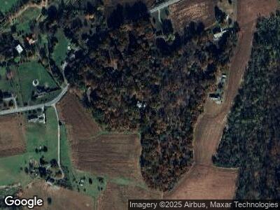
700 Deer Rd Fawn Grove, PA 17321
Estimated Value: $411,000 - $464,151
4
Beds
3
Baths
2,794
Sq Ft
$158/Sq Ft
Est. Value
About This Home
This home is located at 700 Deer Rd, Fawn Grove, PA 17321 and is currently estimated at $442,038, approximately $158 per square foot. 700 Deer Rd is a home located in York County with nearby schools including South Eastern Intermediate School, South Eastern Middle School, and Kennard-Dale High School.
Ownership History
Date
Name
Owned For
Owner Type
Purchase Details
Closed on
Sep 16, 2011
Sold by
Hartel John M and Hartel Jennifer J
Bought by
Wilson Joel K and Wilson Tara Jessica
Current Estimated Value
Home Financials for this Owner
Home Financials are based on the most recent Mortgage that was taken out on this home.
Original Mortgage
$340,159
Interest Rate
4.38%
Mortgage Type
VA
Purchase Details
Closed on
May 31, 2006
Sold by
Mccoy John L and Mccoy Betty J
Bought by
Hartel John M and Hartel Jennifer J
Home Financials for this Owner
Home Financials are based on the most recent Mortgage that was taken out on this home.
Original Mortgage
$180,000
Interest Rate
6.62%
Mortgage Type
Purchase Money Mortgage
Create a Home Valuation Report for This Property
The Home Valuation Report is an in-depth analysis detailing your home's value as well as a comparison with similar homes in the area
Home Values in the Area
Average Home Value in this Area
Purchase History
| Date | Buyer | Sale Price | Title Company |
|---|---|---|---|
| Wilson Joel K | $333,000 | None Available | |
| Hartel John M | $399,900 | None Available |
Source: Public Records
Mortgage History
| Date | Status | Borrower | Loan Amount |
|---|---|---|---|
| Open | Wilson Joel K | $340,430 | |
| Closed | Wilson Joel K | $340,159 | |
| Previous Owner | Hartel Jennifer J | $210,000 | |
| Previous Owner | Hartel Jennifer J | $35,000 | |
| Previous Owner | Hartel John M | $180,000 |
Source: Public Records
Tax History Compared to Growth
Tax History
| Year | Tax Paid | Tax Assessment Tax Assessment Total Assessment is a certain percentage of the fair market value that is determined by local assessors to be the total taxable value of land and additions on the property. | Land | Improvement |
|---|---|---|---|---|
| 2024 | $7,131 | $238,480 | $60,000 | $178,480 |
| 2023 | $7,131 | $238,480 | $60,000 | $178,480 |
| 2022 | $7,131 | $238,480 | $60,000 | $178,480 |
| 2021 | $6,892 | $238,480 | $60,000 | $178,480 |
| 2020 | $6,892 | $238,480 | $60,000 | $178,480 |
| 2019 | $6,868 | $238,480 | $60,000 | $178,480 |
| 2018 | $6,868 | $238,480 | $60,000 | $178,480 |
| 2017 | $6,868 | $238,480 | $60,000 | $178,480 |
| 2016 | $0 | $238,480 | $60,000 | $178,480 |
| 2015 | -- | $238,480 | $60,000 | $178,480 |
| 2014 | -- | $238,480 | $60,000 | $178,480 |
Source: Public Records
Map
Nearby Homes
- 492 Deer Rd
- Lot 3 ANNAPOLIS MODE Ridge Rd
- Lot 5 Fenwick MODEL Ridge Rd
- Lot 5 CAMDEN MODEL Ridge Rd
- 280 Mount Olivet Church Rd
- 23 Cedar Valley Rd
- 164 W Bruce Rd
- 46 Dale Dr
- 381 Mill St
- Lot 5 Ridge Rd
- 9376 Woodbine Rd
- 17 Bluebird Trail
- 0 Robin Trail Unit PAYK2049190
- 684 Norris Rd
- 257 Wiley Mill Rd
- 592 Muddy Creek Rd
- 683 Graceton Rd
- 0 Dogwood Rd
- 267 Cook Rd
- 46 Corn Tassel Rd
