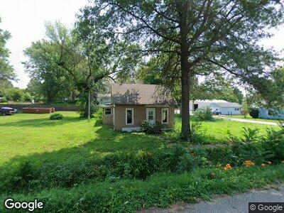
701 Manchester St Emerson, IA 51533
Estimated Value: $43,928 - $125,000
1
Bed
2
Baths
720
Sq Ft
$124/Sq Ft
Est. Value
About This Home
This home is located at 701 Manchester St, Emerson, IA 51533 and is currently estimated at $89,482, approximately $124 per square foot. 701 Manchester St is a home located in Mills County with nearby schools including East Mills Elementary School and East Mills Jr. Sr. High School.
Ownership History
Date
Name
Owned For
Owner Type
Purchase Details
Closed on
Jun 20, 2023
Sold by
Slaven Jacob
Bought by
Sunquist Clayton
Current Estimated Value
Purchase Details
Closed on
May 26, 2021
Sold by
Behen Kristy B and Behen William
Bought by
Slaven Jared D
Purchase Details
Closed on
Jun 3, 2019
Sold by
K Diamond K Holdings
Bought by
Slaven John F and Barton Cheryl
Purchase Details
Closed on
Oct 18, 2013
Sold by
Tiger 109 Partnership
Bought by
Sheppard Bred
Purchase Details
Closed on
Jul 3, 2012
Sold by
County Of Milas
Bought by
Tiger 109 Partnership
Create a Home Valuation Report for This Property
The Home Valuation Report is an in-depth analysis detailing your home's value as well as a comparison with similar homes in the area
Home Values in the Area
Average Home Value in this Area
Purchase History
| Date | Buyer | Sale Price | Title Company |
|---|---|---|---|
| Sunquist Clayton | $5,500 | None Listed On Document | |
| Slaven Jared D | -- | None Listed On Document | |
| Slaven John F | $5,000 | -- | |
| Sheppard Bred | $5,000 | None Available | |
| Tiger 109 Partnership | $479 | None Available |
Source: Public Records
Mortgage History
| Date | Status | Borrower | Loan Amount |
|---|---|---|---|
| Closed | Sheppard Bred | $0 |
Source: Public Records
Tax History Compared to Growth
Tax History
| Year | Tax Paid | Tax Assessment Tax Assessment Total Assessment is a certain percentage of the fair market value that is determined by local assessors to be the total taxable value of land and additions on the property. | Land | Improvement |
|---|---|---|---|---|
| 2024 | $632 | $16,414 | $7,935 | $8,479 |
| 2023 | $486 | $34,292 | $6,961 | $27,331 |
| 2022 | $470 | $26,606 | $6,961 | $19,645 |
| 2021 | $472 | $26,606 | $6,961 | $19,645 |
| 2020 | $472 | $26,606 | $6,961 | $19,645 |
| 2019 | $812 | $25,203 | $0 | $0 |
| 2018 | $464 | $25,203 | $0 | $0 |
| 2017 | $454 | $24,419 | $0 | $0 |
| 2016 | $468 | $27,105 | $0 | $0 |
| 2015 | $474 | $27,105 | $0 | $0 |
| 2014 | $482 | $27,105 | $0 | $0 |
Source: Public Records
Map
Nearby Homes
- 509 King St
- 400 Lowell Ave
- 1252 210th St
- 421 Indian Ave
- 53422 U S Hwy 59
- 409 Highway St
- 509 Maple St
- 17+/- AC Hutchings Ave
- 5+/- ACRES Hutchings Ave
- 111 A St
- 203 W Reed St
- 107 W Oak St
- 107 E Reed St
- 32164 Lambert Ave
- 111 E Grimes St
- 207 E Joy St
- 811 N 3rd St
- 301 E Walnut St
- 306 E Maple St
- 911 Address To Assigned