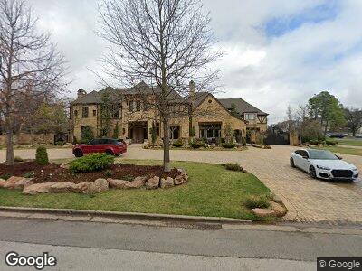
701 W Timberdell Rd Norman, OK 73072
Southwest Norman NeighborhoodEstimated Value: $945,000 - $1,703,602
5
Beds
4
Baths
13,515
Sq Ft
$98/Sq Ft
Est. Value
About This Home
This home is located at 701 W Timberdell Rd, Norman, OK 73072 and is currently estimated at $1,324,301, approximately $97 per square foot. 701 W Timberdell Rd is a home located in Cleveland County with nearby schools including McKinley Elementary School, Alcott Middle School, and Norman High School.
Ownership History
Date
Name
Owned For
Owner Type
Purchase Details
Closed on
Jan 24, 2008
Sold by
Alpha Gamma Of Pi Kappa Phi Building Cor
Bought by
Hunter Miller Family Llc
Current Estimated Value
Home Financials for this Owner
Home Financials are based on the most recent Mortgage that was taken out on this home.
Original Mortgage
$669,213
Interest Rate
6.11%
Mortgage Type
Purchase Money Mortgage
Create a Home Valuation Report for This Property
The Home Valuation Report is an in-depth analysis detailing your home's value as well as a comparison with similar homes in the area
Home Values in the Area
Average Home Value in this Area
Purchase History
| Date | Buyer | Sale Price | Title Company |
|---|---|---|---|
| Hunter Miller Family Llc | $650,000 | None Available |
Source: Public Records
Mortgage History
| Date | Status | Borrower | Loan Amount |
|---|---|---|---|
| Closed | Hunter Miller Family Llc | $975,000 | |
| Closed | Hunter Miller Family Llc | $2,000,000 | |
| Open | Hunter Miller Family Llc | $3,056,914 | |
| Closed | Hunter Military Family Llc | $2,300,000 | |
| Closed | Hunter Miller Family Llc | $669,213 | |
| Previous Owner | Alpha Gamma Of Pi Kappa Phi Buildng Crop | $20,000 |
Source: Public Records
Tax History Compared to Growth
Tax History
| Year | Tax Paid | Tax Assessment Tax Assessment Total Assessment is a certain percentage of the fair market value that is determined by local assessors to be the total taxable value of land and additions on the property. | Land | Improvement |
|---|---|---|---|---|
| 2024 | $39,109 | $326,532 | $17,624 | $308,908 |
| 2023 | $37,343 | $310,982 | $21,044 | $289,938 |
| 2022 | $34,108 | $296,174 | $9,600 | $286,574 |
| 2021 | $35,956 | $296,174 | $9,600 | $286,574 |
| 2020 | $35,183 | $296,174 | $9,600 | $286,574 |
| 2019 | $35,784 | $296,174 | $9,600 | $286,574 |
| 2018 | $34,703 | $296,174 | $9,600 | $286,574 |
| 2017 | $35,091 | $296,174 | $0 | $0 |
| 2016 | $35,668 | $296,174 | $9,600 | $286,574 |
| 2015 | -- | $296,174 | $9,600 | $286,574 |
| 2014 | -- | $291,004 | $143,431 | $147,573 |
Source: Public Records
Map
Nearby Homes
- 1633 Normandie Dr
- 0 Franklin Dr
- 1004 Brookside Dr
- 1103 A Woodland Dr
- 1012 Greenway Cir
- 1013 Greenway Cir
- 1307 Brookside Dr
- 2717 Meadowbrook Dr
- 1032 W Lindsey St
- 2732 Walnut Rd
- 832 S Lahoma Ave
- 2525 Linden Ave
- 823 S Flood Ave
- 1017 Mcfarland St
- 1019 Mcfarland St
- 3000 Chautauqua Ave Unit 146
- 4145 Thunderhead Rd
- 1114 Merrymen Green
- 1400 Aspen Ln
- 705 Chautauqua Ave