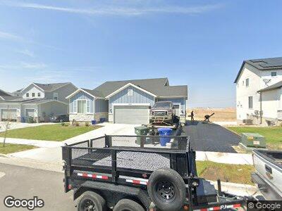
7018 W Hightower Rd West Valley City, UT 84081
Estimated Value: $604,000 - $648,000
3
Beds
2
Baths
3,226
Sq Ft
$195/Sq Ft
Est. Value
About This Home
This home is located at 7018 W Hightower Rd, West Valley City, UT 84081 and is currently estimated at $629,404, approximately $195 per square foot. 7018 W Hightower Rd is a home located in Salt Lake County with nearby schools including Diamond Ridge Elementary School, Thomas Jefferson Jr High School, and Kearns High School.
Ownership History
Date
Name
Owned For
Owner Type
Purchase Details
Closed on
Feb 1, 2022
Sold by
Michael Burns
Bought by
Julian Meranda
Current Estimated Value
Home Financials for this Owner
Home Financials are based on the most recent Mortgage that was taken out on this home.
Original Mortgage
$497,500
Interest Rate
3.55%
Mortgage Type
New Conventional
Purchase Details
Closed on
Jan 28, 2022
Sold by
Michael Burns
Bought by
Julian Meranda
Home Financials for this Owner
Home Financials are based on the most recent Mortgage that was taken out on this home.
Original Mortgage
$497,500
Interest Rate
3.55%
Mortgage Type
New Conventional
Purchase Details
Closed on
Sep 23, 2021
Sold by
Century Communities Of Utah Llc
Bought by
Burns Michael
Home Financials for this Owner
Home Financials are based on the most recent Mortgage that was taken out on this home.
Original Mortgage
$400,000
Interest Rate
2.8%
Mortgage Type
Commercial
Create a Home Valuation Report for This Property
The Home Valuation Report is an in-depth analysis detailing your home's value as well as a comparison with similar homes in the area
Home Values in the Area
Average Home Value in this Area
Purchase History
| Date | Buyer | Sale Price | Title Company |
|---|---|---|---|
| Julian Meranda | -- | Gt Title | |
| Burns Michael | -- | Cottonwood Title | |
| Century Communities Of Utah Llc | -- | Cottonwood Title |
Source: Public Records
Mortgage History
| Date | Status | Borrower | Loan Amount |
|---|---|---|---|
| Closed | Julian Meranda | $497,500 | |
| Previous Owner | Burns Michael | $400,000 |
Source: Public Records
Tax History Compared to Growth
Tax History
| Year | Tax Paid | Tax Assessment Tax Assessment Total Assessment is a certain percentage of the fair market value that is determined by local assessors to be the total taxable value of land and additions on the property. | Land | Improvement |
|---|---|---|---|---|
| 2022 | $1,568 | $541,600 | $140,100 | $401,500 |
| 2021 | $1,568 | $107,400 | $107,400 | $0 |
Source: Public Records
Map
Nearby Homes
- 6509 S Dusky Dr
- 6497 S Luminous Way
- 6696 S Glade Creek Dr Unit 243
- 6812 S Mount Meek Dr Unit 221
- 6817 S Mount Meek Dr Unit 225
- 6832 S Mount Meek Dr Unit 217
- 6848 S Mount Meek Dr Unit 214
- 6842 S Static Peak Dr Unit 263
- 6850 S Static Peak Dr Unit 261
- 6862 S Static Peak Dr Unit 259
- 6871 S Mount Meek Dr Unit 236
- 6864 S Static Peak Dr Unit 258
- 6872 S Static Peak Dr Unit 256
- 6289 S High Bluff Dr
- 6647 S Oakshade Ln
- 6869 S Static Peak Dr Unit 282
- 6462 S High Bluff Dr
- 6849 S Mt Meek Dr Unit 231
- 6533 S Mount Whitney Ln
- 5940 S Woodview Dr