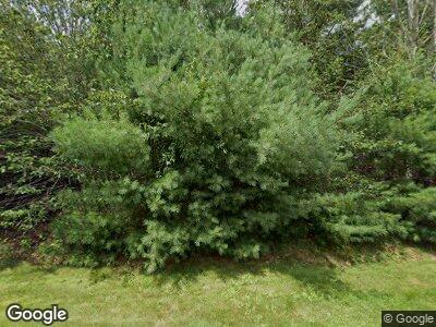
71 Oak Ridge Rd West Greenwich, RI 02817
West Greenwich NeighborhoodEstimated Value: $733,000 - $817,000
4
Beds
3
Baths
2,600
Sq Ft
$296/Sq Ft
Est. Value
About This Home
This home is located at 71 Oak Ridge Rd, West Greenwich, RI 02817 and is currently estimated at $768,710, approximately $295 per square foot. 71 Oak Ridge Rd is a home located in Kent County with nearby schools including Mildred E. Lineham School, Metcalf School, and Wawaloam School.
Ownership History
Date
Name
Owned For
Owner Type
Purchase Details
Closed on
Nov 21, 2024
Sold by
Waterman Lee T and Waterman Lori L
Bought by
Waterman Lori L and Petrarca Michael
Current Estimated Value
Home Financials for this Owner
Home Financials are based on the most recent Mortgage that was taken out on this home.
Original Mortgage
$526,000
Outstanding Balance
$524,515
Interest Rate
6.32%
Mortgage Type
Stand Alone Refi Refinance Of Original Loan
Estimated Equity
$227,238
Purchase Details
Closed on
Feb 14, 2017
Sold by
Hogan Patrick B and Hogan Pamela D
Bought by
Fhlmc
Purchase Details
Closed on
Jul 20, 2004
Sold by
Adc Bldg & Dev
Bought by
Hogan Patrick B and Hogan Pamela D
Create a Home Valuation Report for This Property
The Home Valuation Report is an in-depth analysis detailing your home's value as well as a comparison with similar homes in the area
Home Values in the Area
Average Home Value in this Area
Purchase History
| Date | Buyer | Sale Price | Title Company |
|---|---|---|---|
| Waterman Lori L | -- | None Available | |
| Waterman Lori L | -- | None Available | |
| Waterman Lori L | -- | None Available | |
| Fhlmc | $406,000 | -- | |
| Hogan Patrick B | $489,000 | -- | |
| Fhlmc | $406,000 | -- | |
| Hogan Patrick B | $489,000 | -- |
Source: Public Records
Mortgage History
| Date | Status | Borrower | Loan Amount |
|---|---|---|---|
| Open | Waterman Lori L | $526,000 | |
| Closed | Waterman Lori L | $526,000 | |
| Previous Owner | Waterman Lee T | $361,000 | |
| Previous Owner | Hogan Patrick B | $100,000 | |
| Previous Owner | Hogan Patrick B | $406,000 |
Source: Public Records
Tax History Compared to Growth
Tax History
| Year | Tax Paid | Tax Assessment Tax Assessment Total Assessment is a certain percentage of the fair market value that is determined by local assessors to be the total taxable value of land and additions on the property. | Land | Improvement |
|---|---|---|---|---|
| 2024 | $9,306 | $581,600 | $171,500 | $410,100 |
| 2023 | $10,370 | $423,100 | $131,900 | $291,200 |
| 2022 | $10,370 | $423,100 | $131,900 | $291,200 |
| 2021 | $10,167 | $423,100 | $131,900 | $291,200 |
| 2020 | $10,027 | $421,500 | $131,900 | $289,600 |
| 2019 | $9,927 | $410,700 | $131,900 | $278,800 |
| 2018 | $9,082 | $383,300 | $110,600 | $272,700 |
| 2017 | $8,643 | $383,300 | $110,600 | $272,700 |
| 2016 | $7,750 | $343,700 | $95,400 | $248,300 |
| 2015 | $7,750 | $343,700 | $95,400 | $248,300 |
| 2013 | $8,831 | $391,600 | $105,000 | $286,600 |
Source: Public Records
Map
Nearby Homes
- 475 Robin Hollow Rd
- 716 Victory Hwy
- 526 Victory Hwy
- 0 Stubble Brook Rd
- 271 Austin Farm Rd
- 15 Cedar Pond Way
- 01 Stubble Brook Rd
- 101 Wickaboxet Dr
- 17 Dayna Dr
- 0 W Shore Dr
- 0 W Shore Rd
- 10 W Shore Dr
- 0 E Shore Dr
- 477 Plain Rd
- 92 Black Plain Rd
- 135 Black Plain Rd
- 19 Outlook Way
- 189 Twin Brook Ln
- 2 Scenic Ridge Ct
- 26 Woody Hill Rd
