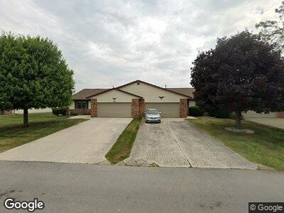
71 Westwood Dr Tiffin, OH 44883
Estimated Value: $196,005 - $215,000
2
Beds
2
Baths
1,534
Sq Ft
$133/Sq Ft
Est. Value
About This Home
This home is located at 71 Westwood Dr, Tiffin, OH 44883 and is currently estimated at $204,751, approximately $133 per square foot. 71 Westwood Dr is a home located in Seneca County with nearby schools including Columbian High School and Calvert High School.
Ownership History
Date
Name
Owned For
Owner Type
Purchase Details
Closed on
Jul 11, 2013
Sold by
Swander Martha J and Swander Tom D
Bought by
Swander Martha J
Current Estimated Value
Purchase Details
Closed on
Sep 14, 2004
Sold by
Pease Jane W
Bought by
Swander Tom D
Purchase Details
Closed on
Apr 6, 2004
Sold by
Pease Robert C
Bought by
Pease Jane W
Purchase Details
Closed on
Apr 2, 1991
Sold by
Fazekas Steve P
Bought by
Pease Robert C
Purchase Details
Closed on
Jan 1, 1989
Create a Home Valuation Report for This Property
The Home Valuation Report is an in-depth analysis detailing your home's value as well as a comparison with similar homes in the area
Home Values in the Area
Average Home Value in this Area
Purchase History
| Date | Buyer | Sale Price | Title Company |
|---|---|---|---|
| Swander Tom D | $107,000 | -- | |
| Pease Jane W | -- | -- | |
| Pease Robert C | $69,900 | -- | |
| -- | $69,900 | -- |
Source: Public Records
Mortgage History
| Date | Status | Borrower | Loan Amount |
|---|---|---|---|
| Open | Swander Tom D | $77,000 |
Source: Public Records
Tax History Compared to Growth
Tax History
| Year | Tax Paid | Tax Assessment Tax Assessment Total Assessment is a certain percentage of the fair market value that is determined by local assessors to be the total taxable value of land and additions on the property. | Land | Improvement |
|---|---|---|---|---|
| 2024 | $1,984 | $58,760 | $3,330 | $55,430 |
| 2023 | $1,984 | $58,760 | $3,330 | $55,430 |
| 2022 | $1,740 | $39,410 | $0 | $39,410 |
| 2021 | $1,616 | $39,410 | $0 | $39,410 |
| 2020 | $1,646 | $39,414 | $0 | $39,414 |
| 2019 | $1,589 | $36,803 | $0 | $36,803 |
| 2018 | $1,683 | $36,803 | $0 | $36,803 |
| 2017 | $1,672 | $36,803 | $0 | $36,803 |
| 2016 | $1,585 | $33,289 | $0 | $33,289 |
| 2015 | $1,569 | $33,289 | $0 | $33,289 |
| 2014 | $1,487 | $33,289 | $0 | $33,289 |
| 2013 | $1,248 | $35,042 | $0 | $35,042 |
Source: Public Records
Map
Nearby Homes
- 0 Shaffer Park Dr Unit 20251435
- 101 E Teakwood Ct
- 0 W Market St
- 0 Township Road 198a Unit 20242098
- 0 Township Road 198a Unit Parcel 4
- 0 County Road 54 Unit 20242258
- 0 Miami St Unit 20242094
- 0 Miami St Unit 20242078
- 0 Miami St Unit Parcel 2 6116475
- 0 Miami St Unit Parcel 3 6116497
- 314 S Sandusky St
- 27 Boehler St
- 2695 Ohio 18
- 235 Front St
- 1660 S Township Road 119
- 215 Hudson St
- 211 Hall St
- 50 Clay St
- 13 Sycamore Woods Ln
- 23 E Perry St