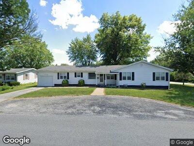
725 Lowry St Pittsfield, IL 62363
Estimated Value: $182,146 - $241,000
4
Beds
2
Baths
2,955
Sq Ft
$67/Sq Ft
Est. Value
About This Home
This home is located at 725 Lowry St, Pittsfield, IL 62363 and is currently estimated at $198,287, approximately $67 per square foot. 725 Lowry St is a home located in Pike County with nearby schools including Pittsfield South Elementary School, Pikeland Community School, and Pittsfield High School.
Ownership History
Date
Name
Owned For
Owner Type
Purchase Details
Closed on
Apr 22, 2024
Sold by
Baldwin Elon and Baldwin Jacqueline J
Bought by
Stendback Patrick P and Stendback Deborah L
Current Estimated Value
Purchase Details
Closed on
Jun 20, 2023
Sold by
Swartz Luetta
Bought by
Baldwin Elon and Baldwin Jacqueline J
Home Financials for this Owner
Home Financials are based on the most recent Mortgage that was taken out on this home.
Original Mortgage
$170,000
Interest Rate
6.39%
Mortgage Type
New Conventional
Purchase Details
Closed on
Aug 26, 2022
Sold by
Mccartney Jr William H
Bought by
Swartz Luetta
Create a Home Valuation Report for This Property
The Home Valuation Report is an in-depth analysis detailing your home's value as well as a comparison with similar homes in the area
Home Values in the Area
Average Home Value in this Area
Purchase History
| Date | Buyer | Sale Price | Title Company |
|---|---|---|---|
| Stendback Patrick P | $120,000 | None Listed On Document | |
| Baldwin Elon | $135,000 | None Listed On Document | |
| Swartz Luetta | $182,500 | None Listed On Document |
Source: Public Records
Mortgage History
| Date | Status | Borrower | Loan Amount |
|---|---|---|---|
| Previous Owner | Baldwin Elon | $170,000 |
Source: Public Records
Tax History Compared to Growth
Tax History
| Year | Tax Paid | Tax Assessment Tax Assessment Total Assessment is a certain percentage of the fair market value that is determined by local assessors to be the total taxable value of land and additions on the property. | Land | Improvement |
|---|---|---|---|---|
| 2023 | $3,209 | $56,180 | $7,020 | $49,160 |
| 2022 | $1,773 | $51,320 | $6,410 | $44,910 |
| 2021 | $1,669 | $49,060 | $6,130 | $42,930 |
| 2020 | $1,686 | $49,060 | $6,130 | $42,930 |
| 2019 | $1,698 | $49,070 | $6,137 | $42,933 |
| 2018 | $1,689 | $48,480 | $6,060 | $42,420 |
| 2015 | $2,752 | $45,160 | $5,650 | $39,510 |
| 2013 | $2,752 | $45,520 | $5,690 | $39,830 |
| 2010 | $2,752 | $45,250 | $5,650 | $39,600 |
Source: Public Records
Map
Nearby Homes
- 201 Mason St
- 520 S Walnut St
- 1225 Sunset Dr
- 614 S Memorial St
- 711 W Perry St
- 715 W Perry St
- 424 W Perry St
- 426 S Monroe St
- 508 N Orchard St
- 321 S Jackson St
- 319 S Jackson St
- 226 S Jackson St
- 428 S Illinois St
- 628 N Orchard St
- 306 E Washington St
- 314 E Washington St
- 220 S Illinois St
- 230 N Illinois St
- 106 E Benson St
- 633 N Monroe St