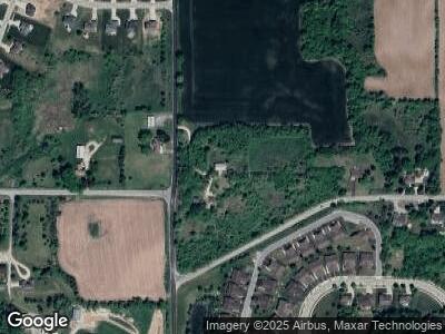
7297 Salisbury Rd West Bend, WI 53090
Estimated Value: $192,000 - $279,000
--
Bed
--
Bath
--
Sq Ft
10
Acres
About This Home
This home is located at 7297 Salisbury Rd, West Bend, WI 53090 and is currently estimated at $240,461. 7297 Salisbury Rd is a home with nearby schools including Green Tree Elementary School, Silverbrook Intermediate School, and East High School.
Ownership History
Date
Name
Owned For
Owner Type
Purchase Details
Closed on
Jul 14, 2022
Sold by
Gundrum Jordan and Estate Of James Gundrum
Bought by
Gundrum Jordan and Gundrum Y
Current Estimated Value
Purchase Details
Closed on
Jan 12, 2017
Sold by
Gundrum Lauri
Bought by
Gundrum James
Purchase Details
Closed on
Nov 16, 2011
Sold by
Rode Fredenck E
Bought by
Gundrum James and Gundrm Lauri
Purchase Details
Closed on
Oct 1, 2011
Sold by
Rode Frederick E
Bought by
Gundrum James J
Create a Home Valuation Report for This Property
The Home Valuation Report is an in-depth analysis detailing your home's value as well as a comparison with similar homes in the area
Home Values in the Area
Average Home Value in this Area
Purchase History
| Date | Buyer | Sale Price | Title Company |
|---|---|---|---|
| Gundrum Jordan | -- | -- | |
| Gundrum James | -- | None Available | |
| Gundrum James | $90,000 | None Available | |
| Gundrum James J | $90,000 | -- |
Source: Public Records
Tax History Compared to Growth
Tax History
| Year | Tax Paid | Tax Assessment Tax Assessment Total Assessment is a certain percentage of the fair market value that is determined by local assessors to be the total taxable value of land and additions on the property. | Land | Improvement |
|---|---|---|---|---|
| 2024 | $991 | $95,800 | $63,000 | $32,800 |
| 2023 | $887 | $95,800 | $63,000 | $32,800 |
| 2022 | $932 | $95,800 | $63,000 | $32,800 |
| 2021 | $975 | $95,800 | $63,000 | $32,800 |
| 2020 | $1,045 | $95,900 | $63,100 | $32,800 |
| 2019 | $979 | $95,800 | $63,000 | $32,800 |
| 2018 | $989 | $95,800 | $63,000 | $32,800 |
| 2017 | $992 | $95,800 | $63,000 | $32,800 |
| 2016 | $1,008 | $85,700 | $63,000 | $22,700 |
| 2015 | $951 | $85,700 | $63,000 | $22,700 |
| 2014 | $951 | $85,700 | $63,000 | $22,700 |
| 2013 | $1,081 | $85,700 | $63,000 | $22,700 |
Source: Public Records
Map
Nearby Homes
- Lt22 Upper Woodford Cir
- 2729 Newark Dr E
- 520 Jackson St
- 2166 Skyline Dr
- 2110 Northwestern Ave
- 2050 Stratford Rd
- 2149 Briar Dr
- 7043 State Highway 144
- Lt3 Woodford Dr
- 2027 Woodlawn Ave
- Lt1 Sleepy Hollow Rd
- Lt2 Woodford Dr
- 520 Roosevelt Dr
- 2548 Wallace Lake Rd
- 2530 Wallace Lake Rd
- 1600 Patricia Dr
- 1427 N 12th Ave
- 1419 N 12th Ave
- 825 Royal Dr
- 7076 Timblin Dr Unit 2
