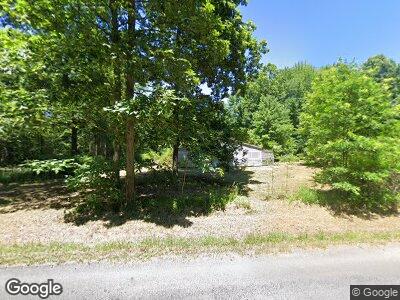
7733 Yale Rd Atwater, OH 44201
Estimated Value: $22,000 - $271,000
2
Beds
1
Bath
1,748
Sq Ft
$56/Sq Ft
Est. Value
About This Home
This home is located at 7733 Yale Rd, Atwater, OH 44201 and is currently estimated at $97,438, approximately $55 per square foot. 7733 Yale Rd is a home located in Portage County with nearby schools including Southeast High School.
Ownership History
Date
Name
Owned For
Owner Type
Purchase Details
Closed on
Mar 4, 2025
Sold by
Lb-Ranch Properties V Llc
Bought by
Mitchell Robert T
Current Estimated Value
Purchase Details
Closed on
Jul 12, 2024
Sold by
Portage County
Bought by
Lb-Ranch Properties V Llc
Purchase Details
Closed on
Feb 10, 2020
Sold by
Wilson Maycil E
Bought by
Wilson Debra
Purchase Details
Closed on
Jan 1, 1990
Bought by
Wilson Maycil E
Create a Home Valuation Report for This Property
The Home Valuation Report is an in-depth analysis detailing your home's value as well as a comparison with similar homes in the area
Home Values in the Area
Average Home Value in this Area
Purchase History
| Date | Buyer | Sale Price | Title Company |
|---|---|---|---|
| Mitchell Robert T | $23,000 | None Listed On Document | |
| Lb-Ranch Properties V Llc | $50,000 | None Listed On Document | |
| Wilson Debra | -- | None Available | |
| Wilson Maycil E | -- | -- |
Source: Public Records
Mortgage History
| Date | Status | Borrower | Loan Amount |
|---|---|---|---|
| Previous Owner | Wilson Maycil E | $77,308 | |
| Previous Owner | Wilson Maycil E | $51,000 | |
| Previous Owner | Wilson Debra A | $16,200 |
Source: Public Records
Tax History Compared to Growth
Tax History
| Year | Tax Paid | Tax Assessment Tax Assessment Total Assessment is a certain percentage of the fair market value that is determined by local assessors to be the total taxable value of land and additions on the property. | Land | Improvement |
|---|---|---|---|---|
| 2024 | $1,125 | $30,810 | $7,110 | $23,700 |
| 2023 | $777 | $18,940 | $6,160 | $12,780 |
| 2022 | $805 | $18,940 | $6,160 | $12,780 |
| 2021 | $812 | $18,940 | $6,160 | $12,780 |
| 2020 | $357 | $16,520 | $5,600 | $10,920 |
| 2019 | $358 | $16,520 | $5,600 | $10,920 |
| 2018 | $579 | $19,190 | $5,430 | $13,760 |
| 2017 | $502 | $19,190 | $5,430 | $13,760 |
| 2016 | $500 | $19,190 | $5,430 | $13,760 |
| 2015 | $479 | $19,190 | $5,430 | $13,760 |
| 2014 | $455 | $18,420 | $5,430 | $12,990 |
| 2013 | $466 | $18,420 | $5,430 | $12,990 |
Source: Public Records
Map
Nearby Homes
- 2823 Porter Rd
- 2390 Alliance Rd
- 2159 Alliance Rd
- 0 Alliance Rd Unit 5077429
- 2617 Ohio 183
- 7489 Tallmadge Rd Parcel 1
- 7489 Tallmadge Parcel 2 Rd
- 0 Ohio 14
- 4039 Ohio 14
- 1749 State Route 14
- 3207 Prairie Cir
- 3229 Prairie Cir
- 0 Moff Rd Unit 5113378
- 0 Moff Rd Unit 5113393
- 0 Moff Rd Unit 5109741
- 1449 Cedar St
- 3024 Ohio 225
- 1376 Fairview Ave
- 1487 Whittlesey Ave
- 1239 Maple Ave