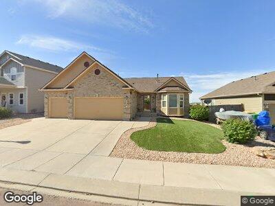
7757 Stockton Dr Fountain, CO 80817
North Fountain Valley NeighborhoodEstimated Value: $443,758 - $484,000
5
Beds
3
Baths
1,344
Sq Ft
$348/Sq Ft
Est. Value
About This Home
This home is located at 7757 Stockton Dr, Fountain, CO 80817 and is currently estimated at $467,190, approximately $347 per square foot. 7757 Stockton Dr is a home located in El Paso County with nearby schools including Webster Elementary School, Janitell Junior High School, and Mesa Ridge High School.
Ownership History
Date
Name
Owned For
Owner Type
Purchase Details
Closed on
Jan 19, 2010
Sold by
Elite Properties Of America Inc
Bought by
Simmons Mark A and Simmons Michelle A
Current Estimated Value
Home Financials for this Owner
Home Financials are based on the most recent Mortgage that was taken out on this home.
Original Mortgage
$293,468
Interest Rate
4.83%
Mortgage Type
VA
Purchase Details
Closed on
Sep 28, 2009
Sold by
Mrl #1 Llc
Bought by
Elite Properties Of America Inc
Home Financials for this Owner
Home Financials are based on the most recent Mortgage that was taken out on this home.
Original Mortgage
$229,834
Interest Rate
5.1%
Mortgage Type
Credit Line Revolving
Create a Home Valuation Report for This Property
The Home Valuation Report is an in-depth analysis detailing your home's value as well as a comparison with similar homes in the area
Home Values in the Area
Average Home Value in this Area
Purchase History
| Date | Buyer | Sale Price | Title Company |
|---|---|---|---|
| Simmons Mark A | $287,290 | Cb Title | |
| Elite Properties Of America Inc | $60,000 | Stewart Title |
Source: Public Records
Mortgage History
| Date | Status | Borrower | Loan Amount |
|---|---|---|---|
| Open | Simmons Mark A | $38,000 | |
| Open | Simmons Mark A | $366,700 | |
| Closed | Simmons Mark A | $366,700 | |
| Closed | Simmons Mark A | $43,400 | |
| Closed | Simmons Mark A | $25,000 | |
| Closed | Simmons Mark A | $309,900 | |
| Closed | Simmons Mark A | $289,791 | |
| Closed | Simmons Mark A | $293,468 | |
| Previous Owner | Elite Properties Of America Inc | $229,834 |
Source: Public Records
Tax History Compared to Growth
Tax History
| Year | Tax Paid | Tax Assessment Tax Assessment Total Assessment is a certain percentage of the fair market value that is determined by local assessors to be the total taxable value of land and additions on the property. | Land | Improvement |
|---|---|---|---|---|
| 2024 | $4,034 | $32,720 | $5,310 | $27,410 |
| 2022 | $3,471 | $24,250 | $4,200 | $20,050 |
| 2021 | $3,453 | $24,950 | $4,320 | $20,630 |
| 2020 | $3,389 | $23,070 | $3,780 | $19,290 |
| 2019 | $3,369 | $23,070 | $3,780 | $19,290 |
| 2018 | $2,615 | $18,500 | $3,800 | $14,700 |
| 2017 | $2,628 | $18,500 | $3,800 | $14,700 |
| 2016 | $2,366 | $19,550 | $3,940 | $15,610 |
| 2015 | $2,397 | $19,550 | $3,940 | $15,610 |
| 2014 | $2,251 | $19,560 | $2,910 | $16,650 |
Source: Public Records
Map
Nearby Homes
- 7719 Paca Place
- 7923 Morton Dr
- 7904 Morton Dr
- 7753 Braxton Dr
- 7578 Sandy Springs Point
- 7662 Sandy Springs Point
- 7584 Dobbs Dr
- 7554 Sandy Springs Point
- 8131 Snow Bowl Heights
- 7555 Dobbs Dr
- 7848 Sandy Springs Point
- 7428 Sandy Springs Point
- 7399 Sandy Springs Point
- 7431 Creekfront Dr
- 7375 Sandy Springs Point
- 7814 Creekfront Dr
- 7859 Peninsula Dr
- 7849 Peninsula Dr
- 8357 Parkglen Dr
- 8417 Brook Valley Dr