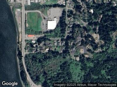
780 H St Coos Bay, OR 97420
Estimated Value: $372,000 - $434,737
3
Beds
2
Baths
1,737
Sq Ft
$232/Sq Ft
Est. Value
About This Home
This home is located at 780 H St, Coos Bay, OR 97420 and is currently estimated at $403,369, approximately $232 per square foot. 780 H St is a home located in Coos County with nearby schools including Eastside School, Millicoma School, and Marshfield Senior High School.
Ownership History
Date
Name
Owned For
Owner Type
Purchase Details
Closed on
Aug 11, 2008
Sold by
Bandon Commons Llc
Bought by
Bain Joseph
Current Estimated Value
Purchase Details
Closed on
May 1, 2008
Sold by
Howell Joseph R and Howell Heather R
Bought by
Sorensen Sherry
Purchase Details
Closed on
Jan 5, 2006
Sold by
Jason Olli
Bought by
Howell Joseph R and Howell Heather R
Home Financials for this Owner
Home Financials are based on the most recent Mortgage that was taken out on this home.
Original Mortgage
$110,000
Interest Rate
6.27%
Mortgage Type
Fannie Mae Freddie Mac
Purchase Details
Closed on
Jun 14, 2005
Sold by
Freeman Robert C
Bought by
Jason Olli
Home Financials for this Owner
Home Financials are based on the most recent Mortgage that was taken out on this home.
Original Mortgage
$140,000
Interest Rate
6%
Mortgage Type
Fannie Mae Freddie Mac
Create a Home Valuation Report for This Property
The Home Valuation Report is an in-depth analysis detailing your home's value as well as a comparison with similar homes in the area
Home Values in the Area
Average Home Value in this Area
Purchase History
| Date | Buyer | Sale Price | Title Company |
|---|---|---|---|
| Bain Joseph | $175,000 | First American Title | |
| Sorensen Sherry | $270,000 | Ticor Title Insurance | |
| Howell Joseph R | $290,000 | Fidelity National Title Co | |
| Jason Olli | $25,000 | Ticor Title Insurance |
Source: Public Records
Mortgage History
| Date | Status | Borrower | Loan Amount |
|---|---|---|---|
| Previous Owner | Howell Joseph R | $110,000 | |
| Previous Owner | Jason Olli | $140,000 |
Source: Public Records
Tax History Compared to Growth
Tax History
| Year | Tax Paid | Tax Assessment Tax Assessment Total Assessment is a certain percentage of the fair market value that is determined by local assessors to be the total taxable value of land and additions on the property. | Land | Improvement |
|---|---|---|---|---|
| 2024 | $5,382 | $309,640 | -- | -- |
| 2023 | $5,219 | $300,630 | $0 | $0 |
| 2022 | $5,134 | $291,880 | $0 | $0 |
| 2021 | $5,001 | $283,380 | $0 | $0 |
| 2020 | $4,860 | $283,380 | $0 | $0 |
| 2019 | $4,666 | $267,120 | $0 | $0 |
| 2018 | $4,505 | $259,340 | $0 | $0 |
| 2017 | $3,992 | $251,790 | $0 | $0 |
| 2016 | $3,790 | $244,460 | $0 | $0 |
| 2015 | $3,698 | $237,340 | $0 | $0 |
| 2014 | $3,684 | $232,690 | $0 | $0 |
Source: Public Records
Map
Nearby Homes
- 0 Shon-Sta Way
- 0 9th Ave
- 570 6th Ave
- 755 17th Ave
- 0 17th Ave Unit 2600 24400970
- 63586 Isthmus Heights Rd
- 545 Whitty St
- 179 2nd Ave
- 156 1st Ave
- 63034 Highway 101
- 63654 Ahill Rd
- 63495 First Rd
- 63764 Harriet Rd
- 93550 Mccullum Ln
- 0 Flanagan Rd
- 0 Andrews Rd
- 63606 Andrews Rd
- 93746 Lorain Ln
- 94320 20th Ln
- 1032 S 4th St
