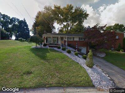
783 Kennedy Ave New Kensington, PA 15068
Estimated Value: $82,352 - $250,000
--
Bed
--
Bath
--
Sq Ft
9,322
Sq Ft Lot
About This Home
This home is located at 783 Kennedy Ave, New Kensington, PA 15068 and is currently estimated at $181,088. 783 Kennedy Ave is a home located in Westmoreland County with nearby schools including Mary Queen of Apostles School.
Ownership History
Date
Name
Owned For
Owner Type
Purchase Details
Closed on
Apr 1, 2022
Sold by
Thimons George H and Thimons Linda L
Bought by
Patterson Lacey Carr
Current Estimated Value
Purchase Details
Closed on
Feb 7, 2007
Sold by
Jones Martha Bengtson and Jones Richard W
Bought by
Thimons George H and Thimons Linda L
Home Financials for this Owner
Home Financials are based on the most recent Mortgage that was taken out on this home.
Original Mortgage
$22,500
Interest Rate
6.4%
Mortgage Type
Stand Alone Second
Create a Home Valuation Report for This Property
The Home Valuation Report is an in-depth analysis detailing your home's value as well as a comparison with similar homes in the area
Home Values in the Area
Average Home Value in this Area
Purchase History
| Date | Buyer | Sale Price | Title Company |
|---|---|---|---|
| Patterson Lacey Carr | -- | None Listed On Document | |
| Thimons George H | $90,000 | None Available |
Source: Public Records
Mortgage History
| Date | Status | Borrower | Loan Amount |
|---|---|---|---|
| Previous Owner | Thimons George H | $22,500 | |
| Previous Owner | Thimons George H | $67,500 |
Source: Public Records
Tax History Compared to Growth
Tax History
| Year | Tax Paid | Tax Assessment Tax Assessment Total Assessment is a certain percentage of the fair market value that is determined by local assessors to be the total taxable value of land and additions on the property. | Land | Improvement |
|---|---|---|---|---|
| 2025 | $2,947 | $18,460 | $4,520 | $13,940 |
| 2024 | $2,919 | $18,460 | $4,520 | $13,940 |
| 2023 | $2,763 | $18,460 | $4,520 | $13,940 |
| 2022 | $2,678 | $18,460 | $4,520 | $13,940 |
| 2021 | $2,617 | $18,460 | $4,520 | $13,940 |
| 2020 | $2,562 | $18,460 | $4,520 | $13,940 |
| 2019 | $2,497 | $18,460 | $4,520 | $13,940 |
| 2018 | $2,461 | $18,460 | $4,520 | $13,940 |
| 2017 | $2,424 | $18,460 | $4,520 | $13,940 |
| 2016 | $2,424 | $18,460 | $4,520 | $13,940 |
| 2015 | $2,424 | $18,460 | $4,520 | $13,940 |
| 2014 | $2,329 | $18,460 | $4,520 | $13,940 |
Source: Public Records
Map
Nearby Homes
- 320 Fernledge Dr
- 700 Earl Ave
- 519 Carl Ave
- 103 Woodstone Ln Unit 53
- 105 Woodstone Ln Unit 61
- 441 Esther Ave
- 436 Esther Ave
- 221 Seneca Dr
- 200 Paul Dr
- 291 Elmtree Rd
- 107 E 1st Ave
- 201 Esther Ave
- 2030 Kimball Ave
- 2018 Kimball Ave
- 104 Worth St
- 408 Craigdell Rd
- 2112 Victoria Ave
- 306 W 7th Ave
- 300 W 7th Ave
- 1917 Kimball Ave