7895 Rockport Cir Lake Worth, FL 33467
Smith Farm NeighborhoodEstimated Value: $539,000 - $561,355
3
Beds
3
Baths
2,054
Sq Ft
$270/Sq Ft
Est. Value
About This Home
This home is located at 7895 Rockport Cir, Lake Worth, FL 33467 and is currently estimated at $553,839, approximately $269 per square foot. 7895 Rockport Cir is a home located in Palm Beach County with nearby schools including Coral Reef Elementary School, Woodlands Middle School, and Park Vista Community High School.
Ownership History
Date
Name
Owned For
Owner Type
Purchase Details
Closed on
Nov 18, 1996
Sold by
Minto Communities Inc
Bought by
Mamone Christophe S and Mamone Christine E
Current Estimated Value
Home Financials for this Owner
Home Financials are based on the most recent Mortgage that was taken out on this home.
Original Mortgage
$119,100
Interest Rate
8.02%
Mortgage Type
New Conventional
Create a Home Valuation Report for This Property
The Home Valuation Report is an in-depth analysis detailing your home's value as well as a comparison with similar homes in the area
Home Values in the Area
Average Home Value in this Area
Purchase History
| Date | Buyer | Sale Price | Title Company |
|---|---|---|---|
| Mamone Christophe S | $152,600 | -- |
Source: Public Records
Mortgage History
| Date | Status | Borrower | Loan Amount |
|---|---|---|---|
| Open | Mamone Christopher S | $191,500 | |
| Closed | Mamone Christine E | $239,500 | |
| Closed | Mamone Christopher S | $242,000 | |
| Closed | Mamone Christopher S | $20,444 | |
| Closed | Mamone Chris | $188,500 | |
| Closed | Mamone Christopher S | $17,000 | |
| Closed | Mamone Christophe S | $119,100 |
Source: Public Records
Tax History Compared to Growth
Tax History
| Year | Tax Paid | Tax Assessment Tax Assessment Total Assessment is a certain percentage of the fair market value that is determined by local assessors to be the total taxable value of land and additions on the property. | Land | Improvement |
|---|---|---|---|---|
| 2024 | $3,933 | $249,389 | -- | -- |
| 2023 | $3,827 | $242,125 | $0 | $0 |
| 2022 | $3,787 | $235,073 | $0 | $0 |
| 2021 | $3,740 | $228,226 | $0 | $0 |
| 2020 | $3,706 | $225,075 | $0 | $0 |
| 2019 | $3,660 | $220,015 | $0 | $0 |
| 2018 | $3,451 | $215,913 | $0 | $0 |
| 2017 | $3,397 | $211,472 | $0 | $0 |
| 2016 | $3,400 | $207,122 | $0 | $0 |
| 2015 | $3,478 | $205,682 | $0 | $0 |
| 2014 | $3,484 | $204,050 | $0 | $0 |
Source: Public Records
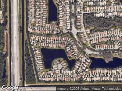
Map
Nearby Homes
- 7841 Rockport Cir
- 6933 Dawntree Ct
- 6562 Columbia Ave
- 6737 Ashburn Rd
- 6761 Columbia Ave
- 7505 Sally Lyn Ln
- 7511 Kingsley Ct
- 6976 Thicket Trce Trace
- 6425 Stonehurst Cir
- 7413 Smithbrooke Dr Unit 7413
- 8163 Alberti Dr
- 6529 Pisano Dr
- 7313 Smithbrooke Dr
- 7309 Smithbrooke Dr
- 7108 Catalina Way
- 7133 Catalina Way
- 7116 Catalina Way
- 7547 Edisto Dr
- 6819 Pisano Dr
- 6346 Squirewood Way