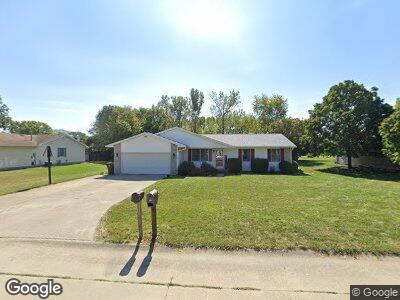
79 Glenbrook Ln Fisher, IL 61843
Estimated Value: $237,000 - $313,000
--
Bed
2
Baths
1,348
Sq Ft
$200/Sq Ft
Est. Value
About This Home
This home is located at 79 Glenbrook Ln, Fisher, IL 61843 and is currently estimated at $269,804, approximately $200 per square foot. 79 Glenbrook Ln is a home located in Champaign County with nearby schools including Fisher Grade School and Fisher Junior/Senior High School.
Ownership History
Date
Name
Owned For
Owner Type
Purchase Details
Closed on
May 14, 2008
Sold by
Williams Steven L and Williams Laura M
Bought by
Carter Joshua A and Carter Geraldine
Current Estimated Value
Home Financials for this Owner
Home Financials are based on the most recent Mortgage that was taken out on this home.
Original Mortgage
$130,000
Interest Rate
5.93%
Mortgage Type
Purchase Money Mortgage
Purchase Details
Closed on
Oct 17, 2005
Sold by
Rogers Craig E and Rogers Lisa M
Bought by
Williams Steven L and Williams Laura M
Home Financials for this Owner
Home Financials are based on the most recent Mortgage that was taken out on this home.
Original Mortgage
$117,000
Interest Rate
5.83%
Mortgage Type
Fannie Mae Freddie Mac
Create a Home Valuation Report for This Property
The Home Valuation Report is an in-depth analysis detailing your home's value as well as a comparison with similar homes in the area
Home Values in the Area
Average Home Value in this Area
Purchase History
| Date | Buyer | Sale Price | Title Company |
|---|---|---|---|
| Carter Joshua A | $162,500 | None Available | |
| Williams Steven L | $157,000 | Allied Title Services |
Source: Public Records
Mortgage History
| Date | Status | Borrower | Loan Amount |
|---|---|---|---|
| Open | Carter Joshua A | $138,045 | |
| Closed | Carter Geraldine | $138,045 | |
| Closed | Carter Josh A | $132,378 | |
| Closed | Carter Josh A | $137,875 | |
| Closed | Carter Joshua A | $128,000 | |
| Closed | Carter Joshua A | $130,000 | |
| Closed | Carter Joshua A | $16,000 | |
| Previous Owner | Williams Steven L | $117,000 | |
| Previous Owner | Rogers Craig E | $107,000 |
Source: Public Records
Tax History Compared to Growth
Tax History
| Year | Tax Paid | Tax Assessment Tax Assessment Total Assessment is a certain percentage of the fair market value that is determined by local assessors to be the total taxable value of land and additions on the property. | Land | Improvement |
|---|---|---|---|---|
| 2023 | $5,017 | $77,260 | $13,760 | $63,500 |
| 2022 | $4,710 | $71,470 | $12,730 | $58,740 |
| 2021 | $4,519 | $68,450 | $12,190 | $56,260 |
| 2020 | $6,335 | $65,880 | $11,730 | $54,150 |
| 2019 | $4,398 | $65,880 | $11,730 | $54,150 |
| 2018 | $4,294 | $63,780 | $11,360 | $52,420 |
| 2017 | $4,365 | $63,140 | $11,360 | $51,780 |
| 2016 | $2,761 | $58,460 | $10,520 | $47,940 |
| 2015 | $2,690 | $56,700 | $10,200 | $46,500 |
| 2014 | $2,605 | $55,420 | $9,970 | $45,450 |
| 2013 | $2,607 | $55,420 | $9,970 | $45,450 |
Source: Public Records
Map
Nearby Homes
- Lot D Us Highway 136
- Lot B Us Highway 136
- 314 E Division St
- 603 Patterson Dr
- 601 Patterson Dr
- 509 Patterson Dr
- 501 Patterson Dr
- 517 Patterson Dr
- 605 Patterson Dr
- 402 Lincoln St
- 319 Lincoln St
- 401 Lincoln St
- 403 Patterson Dr
- 207 E Fairfield St
- 205 E Fairfield St
- 320 Robert Dr
- 612 Jerin Ct
- 611 Jerin Ct
- 601 Jerin Dr
- 511 Jerin Dr