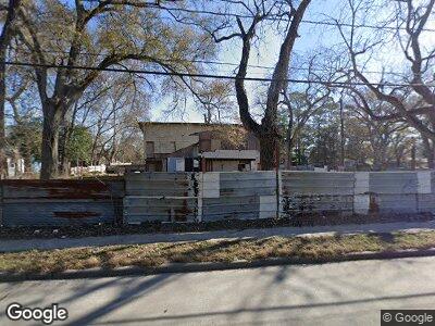
7901 Talton St Houston, TX 77028
East Houston NeighborhoodEstimated Value: $183,720 - $285,000
1
Bed
1
Bath
4,541
Sq Ft
$48/Sq Ft
Est. Value
About This Home
This home is located at 7901 Talton St, Houston, TX 77028 and is currently estimated at $216,430, approximately $47 per square foot. 7901 Talton St is a home located in Harris County with nearby schools including Hiliard Elementary School, Forest Brook Middle, and North Forest High School.
Ownership History
Date
Name
Owned For
Owner Type
Purchase Details
Closed on
May 3, 2016
Sold by
Nelson Johnnie Peck
Bought by
El Ali Zaher Abdelk Arim
Current Estimated Value
Purchase Details
Closed on
Feb 2, 2016
Sold by
Nelson Johnnie Peck and Peck Molly
Bought by
North Forest Independent North Forest In and City Of Houston
Purchase Details
Closed on
Feb 6, 2013
Sold by
Nelson Johnnie Peck
Bought by
Peck Molly
Purchase Details
Closed on
Nov 12, 2006
Sold by
Peck John and Peck Molly
Bought by
Nelson Johnnie Peck
Create a Home Valuation Report for This Property
The Home Valuation Report is an in-depth analysis detailing your home's value as well as a comparison with similar homes in the area
Home Values in the Area
Average Home Value in this Area
Purchase History
| Date | Buyer | Sale Price | Title Company |
|---|---|---|---|
| El Ali Zaher Abdelk Arim | $21,000 | None Available | |
| North Forest Independent North Forest In | -- | None Available | |
| Peck Molly | -- | None Available | |
| Nelson Johnnie Peck | -- | None Available |
Source: Public Records
Mortgage History
| Date | Status | Borrower | Loan Amount |
|---|---|---|---|
| Closed | Rodriguez Gil Alcides Trujillo | $80,000 |
Source: Public Records
Tax History Compared to Growth
Tax History
| Year | Tax Paid | Tax Assessment Tax Assessment Total Assessment is a certain percentage of the fair market value that is determined by local assessors to be the total taxable value of land and additions on the property. | Land | Improvement |
|---|---|---|---|---|
| 2023 | $2,908 | $115,800 | $84,238 | $31,562 |
| 2022 | $1,562 | $70,948 | $41,753 | $29,195 |
| 2021 | $1,598 | $68,553 | $41,753 | $26,800 |
| 2020 | $849 | $35,079 | $31,315 | $3,764 |
| 2019 | $698 | $27,576 | $23,843 | $3,733 |
| 2018 | $546 | $21,582 | $18,313 | $3,269 |
| 2017 | $956 | $37,812 | $18,313 | $19,499 |
| 2016 | $312 | $0 | $0 | $0 |
| 2015 | $1,294 | $56,126 | $8,170 | $47,956 |
| 2014 | $1,294 | $50,324 | $8,170 | $42,154 |
Source: Public Records
Map
Nearby Homes
- 9002 N Wayside Dr
- 0 Lynette
- 7930 Snowden St
- 8001 Laura Koppe Rd
- 0 Snowden St
- 7934 Record St
- 7936 Record St
- 7921 Oak Knoll Ln
- 8106 Talton
- 7902 Count St
- 8038 Woodlyn Rd
- 8610 Tremont St
- 8104 Woodlyn Rd
- 8115 Woodlyn Rd
- 7940 Record St
- 7938 Record St
- 8145 Homewood Ln
- 7901 Richland Dr
- 8149 Homewood Ln
- 7825 Richland Dr