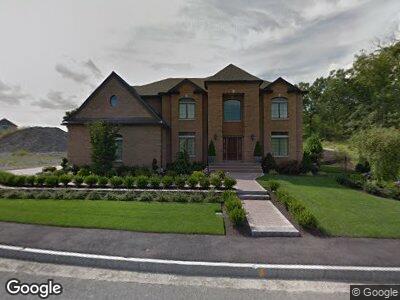
8 Iron Works Way Saugus, MA 01906
Lynnhurst NeighborhoodEstimated Value: $982,000 - $1,277,000
4
Beds
3
Baths
3,246
Sq Ft
$350/Sq Ft
Est. Value
About This Home
This home is located at 8 Iron Works Way, Saugus, MA 01906 and is currently estimated at $1,135,664, approximately $349 per square foot. 8 Iron Works Way is a home located in Essex County with nearby schools including Saugus High School, Pioneer Charter School Of Science II, and Sacred Heart School.
Ownership History
Date
Name
Owned For
Owner Type
Purchase Details
Closed on
Sep 29, 2017
Sold by
Ra T 2012
Bought by
Rgr Lt
Current Estimated Value
Purchase Details
Closed on
Sep 5, 2012
Sold by
Tremblay Cheryl A and Tremblay Scott M
Bought by
Ra 2012 T and Reilly Robert G
Purchase Details
Closed on
Nov 18, 2010
Sold by
Vinegar Hill Estates T and Procopio Kevin F
Bought by
Reilly Scott M and Reilly-Trembla Cherylann
Create a Home Valuation Report for This Property
The Home Valuation Report is an in-depth analysis detailing your home's value as well as a comparison with similar homes in the area
Home Values in the Area
Average Home Value in this Area
Purchase History
| Date | Buyer | Sale Price | Title Company |
|---|---|---|---|
| Rgr Lt | -- | -- | |
| Ra 2012 T | -- | -- | |
| Reilly Scott M | $289,000 | -- |
Source: Public Records
Tax History Compared to Growth
Tax History
| Year | Tax Paid | Tax Assessment Tax Assessment Total Assessment is a certain percentage of the fair market value that is determined by local assessors to be the total taxable value of land and additions on the property. | Land | Improvement |
|---|---|---|---|---|
| 2025 | $10,839 | $1,014,900 | $378,000 | $636,900 |
| 2024 | $10,562 | $991,700 | $363,600 | $628,100 |
| 2023 | $10,412 | $924,700 | $330,100 | $594,600 |
| 2022 | $9,955 | $828,900 | $300,500 | $528,400 |
| 2021 | $9,700 | $786,100 | $261,200 | $524,900 |
| 2020 | $9,345 | $784,000 | $261,200 | $522,800 |
| 2019 | $9,079 | $745,400 | $248,800 | $496,600 |
| 2018 | $8,401 | $725,500 | $236,400 | $489,100 |
| 2017 | $8,221 | $682,200 | $224,900 | $457,300 |
| 2016 | $8,857 | $726,000 | $215,400 | $510,600 |
| 2015 | $8,309 | $691,300 | $205,000 | $486,300 |
| 2014 | $7,883 | $679,000 | $205,000 | $474,000 |
Source: Public Records
Map
Nearby Homes
- 21 Mccullough Rd
- 75 Fairmount Ave
- 4 Rockland Terrace
- 4 Oneil Way
- 48 Hayes St
- 215 Central St
- 24 Hayes St
- 11 Taylor St Unit B
- 4 Pranker Rd
- 28 Greystone Rd
- 10 Jones Dr
- 7 Emory St
- 25 Columbus Ave
- 355 Central St
- 363 Central St
- 747 Boston St
- 78 Main St
- 32 Birch Brook Rd Unit 17
- 32 Birch Brook Rd Unit 25
- 32 Birch Brook Rd Unit 27