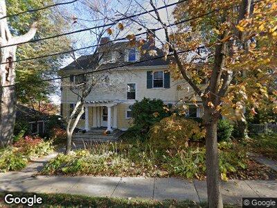
8 Kensington Rd Arlington, MA 02476
Arlington Center NeighborhoodEstimated Value: $1,972,445 - $2,575,000
5
Beds
4
Baths
4,070
Sq Ft
$548/Sq Ft
Est. Value
About This Home
This home is located at 8 Kensington Rd, Arlington, MA 02476 and is currently estimated at $2,230,361, approximately $548 per square foot. 8 Kensington Rd is a home located in Middlesex County with nearby schools including Bishop Elementary School, Ottoson Middle School, and Arlington High School.
Ownership History
Date
Name
Owned For
Owner Type
Purchase Details
Closed on
Jun 1, 1985
Bought by
Gildesgame Myron L and Gildesgame Catharyn B
Current Estimated Value
Create a Home Valuation Report for This Property
The Home Valuation Report is an in-depth analysis detailing your home's value as well as a comparison with similar homes in the area
Home Values in the Area
Average Home Value in this Area
Purchase History
| Date | Buyer | Sale Price | Title Company |
|---|---|---|---|
| Gildesgame Myron L | -- | -- |
Source: Public Records
Mortgage History
| Date | Status | Borrower | Loan Amount |
|---|---|---|---|
| Open | Gildesgame Catharyn B | $350,000 | |
| Closed | Gildesgame Catharyn B | $350,000 | |
| Open | Gildesgame Myron L | $750,000 | |
| Closed | Gildesgame Myron L | $750,000 | |
| Closed | Gildesgame Myron L | $750,000 | |
| Closed | Gildesgame Myron L | $500,000 |
Source: Public Records
Tax History Compared to Growth
Tax History
| Year | Tax Paid | Tax Assessment Tax Assessment Total Assessment is a certain percentage of the fair market value that is determined by local assessors to be the total taxable value of land and additions on the property. | Land | Improvement |
|---|---|---|---|---|
| 2024 | $18,944 | $1,788,900 | $804,100 | $984,800 |
| 2023 | $18,394 | $1,640,900 | $735,800 | $905,100 |
| 2022 | $17,230 | $1,508,800 | $682,700 | $826,100 |
| 2021 | $16,847 | $1,485,600 | $682,700 | $802,900 |
| 2020 | $16,429 | $1,485,400 | $682,700 | $802,700 |
| 2019 | $14,941 | $1,326,900 | $720,700 | $606,200 |
| 2018 | $13,794 | $1,137,200 | $531,000 | $606,200 |
| 2017 | $13,940 | $1,109,900 | $508,200 | $601,700 |
| 2016 | $13,722 | $1,072,000 | $470,300 | $601,700 |
| 2015 | $13,316 | $982,700 | $394,500 | $588,200 |
Source: Public Records
Map
Nearby Homes
- 46 Norfolk Rd
- 68 Brantwood Rd
- 135 Pleasant St Unit 24
- 9 Venner Rd
- 79 Tobey Rd
- 146 Gray St
- 38 High Haith Rd
- 19 Scott Rd
- 33 Ottawa Rd
- 10 Willow Ct Unit B
- 30 Chilton St
- 6 Whittemore St
- 6 Whittemore St Unit 6
- 108 Radcliffe Rd
- 13 Newport St Unit 1
- 9 Eastern Ave
- 7 Russell Place Unit 7
- 5 Belknap St Unit 7A
- 113 Mount Vernon St Unit 2
- 55 Coolidge Rd