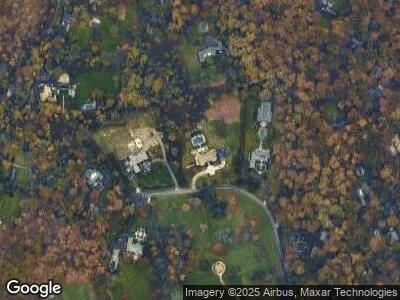
8 La Colline Dr Mill Neck, NY 11765
Estimated Value: $6,452,068
--
Bed
7
Baths
9,749
Sq Ft
$662/Sq Ft
Est. Value
About This Home
This home is located at 8 La Colline Dr, Mill Neck, NY 11765 and is currently estimated at $6,452,068, approximately $661 per square foot. 8 La Colline Dr is a home located in Nassau County with nearby schools including Locust Valley High School, Portledge School, and St Dominic Elementary and Middle School.
Ownership History
Date
Name
Owned For
Owner Type
Purchase Details
Closed on
May 8, 2003
Sold by
Dasaro Frank
Bought by
Mott Bradford
Current Estimated Value
Purchase Details
Closed on
Feb 27, 1995
Sold by
Columbia Federal Savings Bank
Bought by
Agf Development Inc
Home Financials for this Owner
Home Financials are based on the most recent Mortgage that was taken out on this home.
Original Mortgage
$2,328,000
Interest Rate
8.89%
Mortgage Type
Purchase Money Mortgage
Create a Home Valuation Report for This Property
The Home Valuation Report is an in-depth analysis detailing your home's value as well as a comparison with similar homes in the area
Home Values in the Area
Average Home Value in this Area
Purchase History
| Date | Buyer | Sale Price | Title Company |
|---|---|---|---|
| Mott Bradford | $3,000,000 | -- | |
| Agf Development Inc | $323,333 | -- |
Source: Public Records
Mortgage History
| Date | Status | Borrower | Loan Amount |
|---|---|---|---|
| Open | Mott Bradford | $5,000,000 | |
| Previous Owner | Dasaro Frank J | $900,000 | |
| Previous Owner | Agf Development Inc | $2,328,000 |
Source: Public Records
Tax History Compared to Growth
Tax History
| Year | Tax Paid | Tax Assessment Tax Assessment Total Assessment is a certain percentage of the fair market value that is determined by local assessors to be the total taxable value of land and additions on the property. | Land | Improvement |
|---|---|---|---|---|
| 2024 | $19,832 | $4,865 | $1,261 | $3,604 |
| 2023 | $88,535 | $4,590 | $1,072 | $3,518 |
| 2022 | $36,789 | $1,480 | $1,242 | $238 |
| 2021 | $39,197 | $1,424 | $1,195 | $229 |
| 2020 | $39,044 | $3,977 | $3,154 | $823 |
| 2019 | $45,053 | $5,116 | $3,154 | $1,962 |
| 2018 | $54,394 | $5,116 | $0 | $0 |
| 2017 | $38,341 | $5,116 | $2,437 | $2,679 |
| 2016 | $49,077 | $6,622 | $3,154 | $3,468 |
| 2015 | $11,694 | $6,622 | $2,466 | $4,156 |
| 2014 | $11,694 | $6,622 | $2,466 | $4,156 |
| 2013 | $10,992 | $6,622 | $2,466 | $4,156 |
Source: Public Records
Map
Nearby Homes