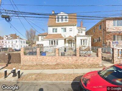
801 S Oak Dr Bronx, NY 10467
Olinville NeighborhoodEstimated Value: $764,000 - $879,000
4
Beds
3
Baths
2,250
Sq Ft
$371/Sq Ft
Est. Value
About This Home
This home is located at 801 S Oak Dr, Bronx, NY 10467 and is currently estimated at $834,333, approximately $370 per square foot. 801 S Oak Dr is a home located in Bronx County with nearby schools including P.S. 76 The Bennington School, North Bronx School of Empowerment, and Immaculate Conception School.
Ownership History
Date
Name
Owned For
Owner Type
Purchase Details
Closed on
Feb 18, 2009
Sold by
Sanichara Harry and Sukhram Dhanwattie
Bought by
Sanichara Harry and Sukhram Dhanwattie
Current Estimated Value
Purchase Details
Closed on
Jun 18, 1999
Sold by
Hughes Zubida
Bought by
Sanichara Harry and Sukhram Dhanwattie
Home Financials for this Owner
Home Financials are based on the most recent Mortgage that was taken out on this home.
Original Mortgage
$220,000
Interest Rate
7.83%
Create a Home Valuation Report for This Property
The Home Valuation Report is an in-depth analysis detailing your home's value as well as a comparison with similar homes in the area
Home Values in the Area
Average Home Value in this Area
Purchase History
| Date | Buyer | Sale Price | Title Company |
|---|---|---|---|
| Sanichara Harry | -- | -- | |
| Sanichara Harry | $245,000 | First American Title Ins Co |
Source: Public Records
Mortgage History
| Date | Status | Borrower | Loan Amount |
|---|---|---|---|
| Previous Owner | Sanichara Harry | $240,000 | |
| Previous Owner | Sanichara Harry | $220,000 |
Source: Public Records
Tax History Compared to Growth
Tax History
| Year | Tax Paid | Tax Assessment Tax Assessment Total Assessment is a certain percentage of the fair market value that is determined by local assessors to be the total taxable value of land and additions on the property. | Land | Improvement |
|---|---|---|---|---|
| 2024 | $5,966 | $31,104 | $5,589 | $25,515 |
| 2023 | $6,033 | $31,104 | $4,808 | $26,296 |
| 2022 | $5,674 | $50,880 | $8,700 | $42,180 |
| 2021 | $5,688 | $42,180 | $8,700 | $33,480 |
| 2020 | $5,389 | $36,060 | $8,700 | $27,360 |
| 2019 | $5,129 | $36,060 | $8,700 | $27,360 |
| 2018 | $4,986 | $25,920 | $6,013 | $19,907 |
| 2017 | $4,773 | $24,883 | $7,033 | $17,850 |
| 2016 | $4,432 | $23,722 | $7,077 | $16,645 |
| 2015 | $2,611 | $22,380 | $9,660 | $12,720 |
| 2014 | $2,611 | $21,600 | $9,660 | $11,940 |
Source: Public Records
Map
Nearby Homes
- 804 Bartholdi St
- 780 Bartholdi St
- 3300 Holland Ave
- 3011 Matthews Ave
- 3002 Barnes Ave
- 829 Adee Ave Unit 5N
- 829 Adee Ave Unit 2L
- 829 Adee Ave Unit 3N
- 3301 Cruger Ave
- 942 Magenta St
- 2994 Holland Ave
- 2934 Wallace Ave
- 740 Adee Ave
- 3212 Paulding Ave
- 3210 Paulding Ave
- 2922 Barnes Ave Unit 3A
- 2922 Barnes Ave Unit 3E
- 2922 Barnes Ave Unit 1H
- 2922 Barnes Ave Unit 6E
- 2925 Matthews Ave Unit 5C