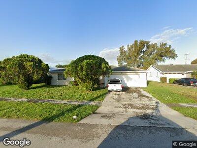
807 S Mangonia Cir West Palm Beach, FL 33401
Roosevelt Estates NeighborhoodEstimated Value: $469,000 - $521,000
3
Beds
2
Baths
1,936
Sq Ft
$256/Sq Ft
Est. Value
About This Home
This home is located at 807 S Mangonia Cir, West Palm Beach, FL 33401 and is currently estimated at $495,913, approximately $256 per square foot. 807 S Mangonia Cir is a home located in Palm Beach County with nearby schools including Westward Elementary School, Bear Lakes Middle School, and Palm Beach Lakes Community High School.
Ownership History
Date
Name
Owned For
Owner Type
Purchase Details
Closed on
May 1, 2017
Bought by
Srp Sub Llc
Current Estimated Value
Purchase Details
Closed on
May 24, 2013
Sold by
Hankin Stu and The 807 Mangonia Land Trust
Bought by
Srp Sub Llc
Purchase Details
Closed on
Dec 27, 2012
Sold by
Walker Percy
Bought by
807 Mangonia Land Trust and Hankin Stu
Purchase Details
Closed on
Apr 4, 2000
Sold by
Murray Carolyn R and Murray David G
Bought by
Walker Percy
Home Financials for this Owner
Home Financials are based on the most recent Mortgage that was taken out on this home.
Original Mortgage
$68,000
Interest Rate
8.38%
Mortgage Type
New Conventional
Create a Home Valuation Report for This Property
The Home Valuation Report is an in-depth analysis detailing your home's value as well as a comparison with similar homes in the area
Home Values in the Area
Average Home Value in this Area
Purchase History
| Date | Buyer | Sale Price | Title Company |
|---|---|---|---|
| Srp Sub Llc | -- | -- | |
| Srp Sub Llc | $157,600 | Attorney | |
| 807 Mangonia Land Trust | $87,900 | None Available | |
| Walker Percy | $85,000 | -- |
Source: Public Records
Mortgage History
| Date | Status | Borrower | Loan Amount |
|---|---|---|---|
| Previous Owner | Walker Percy | $68,000 |
Source: Public Records
Tax History Compared to Growth
Tax History
| Year | Tax Paid | Tax Assessment Tax Assessment Total Assessment is a certain percentage of the fair market value that is determined by local assessors to be the total taxable value of land and additions on the property. | Land | Improvement |
|---|---|---|---|---|
| 2024 | $7,925 | $344,579 | -- | -- |
| 2023 | $7,284 | $313,254 | $97,594 | $299,705 |
| 2022 | $6,828 | $284,776 | $0 | $0 |
| 2021 | $6,195 | $300,599 | $99,000 | $201,599 |
| 2020 | $5,938 | $305,848 | $99,000 | $206,848 |
| 2019 | $5,348 | $259,797 | $71,500 | $188,297 |
| 2018 | $4,433 | $194,505 | $55,317 | $139,188 |
| 2017 | $4,500 | $196,410 | $55,317 | $141,093 |
| 2016 | $4,232 | $178,108 | $0 | $0 |
| 2015 | $3,927 | $161,916 | $0 | $0 |
| 2014 | $3,679 | $149,516 | $0 | $0 |
Source: Public Records
Map
Nearby Homes
- 1434 8th St
- 1501 11th St
- 660 Amador Ln Unit 1635
- 770 Millbrae Ct Unit 4
- 820 Millbrae Ct Unit 1
- 750 Millbrae Ct Unit 3
- 833 Millbrae Ct Unit 6
- 833 Millbrae Ct Unit 5
- 661 Corte Madera Ln Unit 1
- 661 Corte Madera Ln Unit 4
- 1487 N Mangonia Dr
- 960 Millbrae Ct Unit 5
- 1730 Borrego Way Unit 2232
- 939 Millbrae Ct Unit 1
- 1400 13th St
- 1365 11th St
- 855 Marina Del Ray Ln Unit 4
- 855 Marina Del Ray Ln Unit 1
- 1740 San Benito Way Unit 2532
- 580 Pacific Grove Dr Unit 3