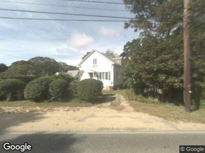
81 County Rd Vineyard Haven, MA 02568
Oak Bluffs NeighborhoodEstimated Value: $959,000 - $1,112,000
4
Beds
2
Baths
1,176
Sq Ft
$866/Sq Ft
Est. Value
About This Home
This home is located at 81 County Rd, Vineyard Haven, MA 02568 and is currently estimated at $1,018,623, approximately $866 per square foot. 81 County Rd is a home located in Dukes County with nearby schools including Oak Bluffs Elementary School, Martha's Vineyard Regional High School, and Vineyard Montessori School.
Ownership History
Date
Name
Owned For
Owner Type
Purchase Details
Closed on
May 1, 2003
Sold by
Gibson Nancy B
Bought by
Vertefeuille Evelyn and Vertefeuille Paul
Current Estimated Value
Home Financials for this Owner
Home Financials are based on the most recent Mortgage that was taken out on this home.
Original Mortgage
$228,000
Interest Rate
5.82%
Mortgage Type
Purchase Money Mortgage
Create a Home Valuation Report for This Property
The Home Valuation Report is an in-depth analysis detailing your home's value as well as a comparison with similar homes in the area
Home Values in the Area
Average Home Value in this Area
Purchase History
| Date | Buyer | Sale Price | Title Company |
|---|---|---|---|
| Vertefeuille Evelyn | $285,000 | -- |
Source: Public Records
Mortgage History
| Date | Status | Borrower | Loan Amount |
|---|---|---|---|
| Open | Vertefeuille Evelyn | $208,250 | |
| Closed | Gibson Nancy B | $228,000 | |
| Closed | Gibson Nancy B | $42,750 | |
| Previous Owner | Gibson Nancy B | $10,650 | |
| Previous Owner | Gibson Nancy B | $149,500 |
Source: Public Records
Tax History Compared to Growth
Tax History
| Year | Tax Paid | Tax Assessment Tax Assessment Total Assessment is a certain percentage of the fair market value that is determined by local assessors to be the total taxable value of land and additions on the property. | Land | Improvement |
|---|---|---|---|---|
| 2025 | $3,964 | $785,000 | $524,400 | $260,600 |
| 2024 | $3,928 | $751,000 | $476,500 | $274,500 |
| 2023 | $4,205 | $796,400 | $505,100 | $291,300 |
| 2022 | $4,187 | $616,700 | $396,300 | $220,400 |
| 2021 | $14,447 | $475,700 | $296,000 | $179,700 |
| 2020 | $704 | $448,200 | $281,900 | $166,300 |
| 2019 | $3,250 | $422,600 | $259,400 | $163,200 |
| 2018 | $13,882 | $366,900 | $203,700 | $163,200 |
| 2017 | $2,762 | $338,900 | $193,100 | $145,800 |
| 2016 | $2,686 | $331,200 | $199,100 | $132,100 |
| 2015 | $2,564 | $322,100 | $199,100 | $123,000 |
| 2014 | $2,406 | $308,100 | $181,200 | $126,900 |
Source: Public Records
Map
Nearby Homes
- 112 County Rd
- 28 Roger's Way
- 70 Carol Ln
- 25 Hampson Ave
- 10 Kims Way
- 2 Upper Douglas Ln
- 249 County Rd
- 7 Highland Ave
- 181 Circuit Ave
- 4 Dempster Park
- 51 Rural Cir
- 37 Circuit Ave Unit 5
- 37 Circuit Ave Unit 4
- 1 Cottage Park
- 2 Fisk Ave
- 34 Massasoit Ave
- 33 Clay Ave
- 47 E Chop Dr Unit 1
- 47 E Chop Dr
- 35 Tuckernuck Ave