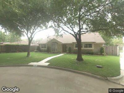
8203 Burning Hills Dr Houston, TX 77071
Brays Oaks NeighborhoodEstimated Value: $321,691 - $363,000
4
Beds
3
Baths
2,535
Sq Ft
$136/Sq Ft
Est. Value
About This Home
This home is located at 8203 Burning Hills Dr, Houston, TX 77071 and is currently estimated at $344,173, approximately $135 per square foot. 8203 Burning Hills Dr is a home located in Harris County with nearby schools including A.A. Milne Elementary School, Welch Middle School, and Sharpstown High School.
Ownership History
Date
Name
Owned For
Owner Type
Purchase Details
Closed on
Jan 25, 2019
Sold by
Davis Sandra K and Coventon James A
Bought by
Spears Ryan J and Spears Toni L
Current Estimated Value
Home Financials for this Owner
Home Financials are based on the most recent Mortgage that was taken out on this home.
Original Mortgage
$208,050
Interest Rate
4.6%
Mortgage Type
New Conventional
Create a Home Valuation Report for This Property
The Home Valuation Report is an in-depth analysis detailing your home's value as well as a comparison with similar homes in the area
Home Values in the Area
Average Home Value in this Area
Purchase History
| Date | Buyer | Sale Price | Title Company |
|---|---|---|---|
| Spears Ryan J | -- | Capital Title |
Source: Public Records
Mortgage History
| Date | Status | Borrower | Loan Amount |
|---|---|---|---|
| Open | Spears Ryan | $213,750 | |
| Closed | Spears Ryan J | $208,050 |
Source: Public Records
Tax History Compared to Growth
Tax History
| Year | Tax Paid | Tax Assessment Tax Assessment Total Assessment is a certain percentage of the fair market value that is determined by local assessors to be the total taxable value of land and additions on the property. | Land | Improvement |
|---|---|---|---|---|
| 2023 | $4,190 | $334,173 | $121,794 | $212,379 |
| 2022 | $6,622 | $304,128 | $121,794 | $182,334 |
| 2021 | $6,095 | $261,519 | $121,794 | $139,725 |
| 2020 | $6,374 | $252,796 | $121,794 | $131,002 |
| 2019 | $6,650 | $252,796 | $121,794 | $131,002 |
| 2018 | $922 | $243,330 | $121,794 | $121,536 |
| 2017 | $5,762 | $243,330 | $121,794 | $121,536 |
| 2016 | $5,238 | $243,330 | $121,794 | $121,536 |
| 2015 | $931 | $235,973 | $121,794 | $114,179 |
| 2014 | $931 | $183,627 | $81,196 | $102,431 |
Source: Public Records
Map
Nearby Homes
- 8123 Braesview Ln
- 8011 Burning Hills Dr
- 8100 Creekbend Dr Unit 138
- 8100 Creekbend Dr Unit 146
- 8100 Creekbend Dr Unit 143
- 8100 Creekbend Dr Unit 126
- 8100 Creekbend Dr Unit 149
- 8100 Creekbend Dr Unit 192
- 8100 Creekbend Dr Unit 170
- 8100 Creekbend Dr Unit 152
- 8100 Creekbend Dr Unit 159
- 8245 Creekbend Dr Unit 8245
- 10101 S Gessner Rd Unit 409
- 10101 S Gessner Rd Unit 912
- 10101 S Gessner Rd Unit 502
- 10655 Braes Bend Dr
- 10726 Shawnbrook Dr
- 10755 Braes Bend Dr
- 10738 Villa Lea Ln
- 10726 Paulwood Dr