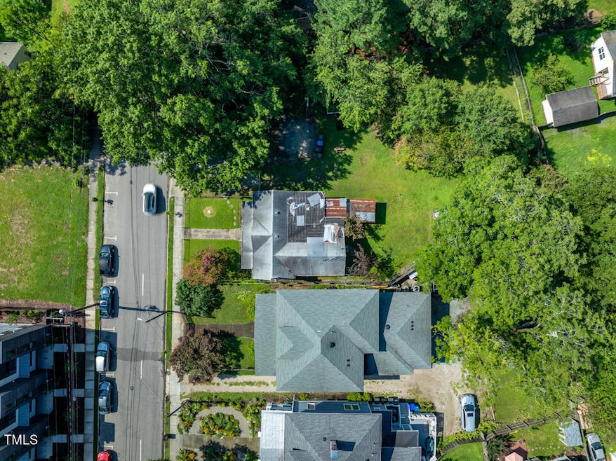
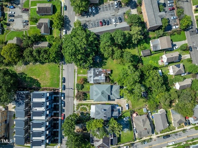
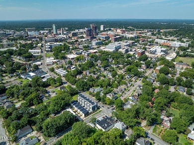
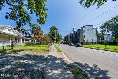
829 N Mangum St Durham, NC 27701
Central Park NeighborhoodEstimated payment $5,846/month
Highlights
- 0.38 Acre Lot
- Partially Wooded Lot
- 4-minute walk to Bay-Hargrove Park
- George Watts Elementary Rated A-
- No HOA
About This Lot
829 N Mangum St This property is split zoned between CG (95%) and RU-M (5%), located in the Urban tier. It is not in a flood zone. There are no streams affecting the property. It is not in a Watershed Protection Overlay.
Located in the North Durham-Duke Park National District. Built in 1900
To answer your questions:
Can the property be torn down: You would need to get a demolition permit from the Inspections Department. If the property is located within a National Historic District, then a rehabilitation of the existing structure could likely qualify for historic rehabilitation tax credits through the North Carolina State Historic Preservation Office ( NCHPO ) (15% for non-income-producing properties and 35-45% for income-producing properties).
For the CG portion, Setbacks and height limits can be found in section 6.10.1 , Nonresidential and Group Living Development Standards. For the RU-M portion, you will consult section 7.1.2
Here you can find the Historic Properties Local Review Criteria.
Here's a link to the Durham maps: https://maps.durhamnc.gov/?x=36.00316905585123&y=-78.89582251949918&z=1128.4971765&r=0&b=11&a=-1&u=0&pid=110190&s=custom&l=zoning,#
You can always hit reply to this email if you need to follow up. This ticket will auto-close in 10 days. if it does, you can email Planning@durhamnc.gov with your ticket number.
Best regards,
Luis Salazar Gonzalez (he/him)
Planning Specialist
Hablo español
Durham City-County Planning Department
101 City Hall Plaza, Ground Floor, Suite G500
Durham, NC 27701
Planning@DurhamNC.gov
Property Details
Property Type
- Land
Est. Annual Taxes
- $6,513
Year Built
- 1900
Lot Details
- 0.38 Acre Lot
- Lot Dimensions are 87x162x52x187
- Partially Wooded Lot
- Property is zoned CG
Schools
- Glenn Elementary School
- Brogden Middle School
- Riverside High School
Utilities
- Phone Available
- Cable TV Available
Community Details
- No Home Owners Association
Listing and Financial Details
- Assessor Parcel Number 0832-10-0005
Map
Home Values in the Area
Average Home Value in this Area
Tax History
| Year | Tax Paid | Tax Assessment Tax Assessment Total Assessment is a certain percentage of the fair market value that is determined by local assessors to be the total taxable value of land and additions on the property. | Land | Improvement |
|---|---|---|---|---|
| 2024 | $1,311 | $187,939 | $133,000 | $54,939 |
| 2023 | $1,231 | $187,939 | $133,000 | $54,939 |
| 2022 | $1,203 | $187,939 | $133,000 | $54,939 |
| 2021 | $1,197 | $187,939 | $133,000 | $54,939 |
| 2020 | $1,169 | $187,939 | $133,000 | $54,939 |
| 2019 | $1,169 | $187,939 | $133,000 | $54,939 |
| 2018 | $868 | $127,995 | $51,750 | $76,245 |
| 2017 | $862 | $127,995 | $51,750 | $76,245 |
| 2016 | $833 | $127,995 | $51,750 | $76,245 |
| 2015 | $890 | $128,570 | $82,764 | $45,806 |
| 2014 | $890 | $128,570 | $82,764 | $45,806 |
Property History
| Date | Event | Price | Change | Sq Ft Price |
|---|---|---|---|---|
| 03/17/2025 03/17/25 | For Sale | $950,000 | 0.0% | -- |
| 11/23/2024 11/23/24 | Pending | -- | -- | -- |
| 08/16/2024 08/16/24 | For Sale | $950,000 | -- | -- |
Source: Doorify MLS
MLS Number: 10047370
APN: 110190
Disclaimer: Certain information contained herein is derived from information provided by parties other than Homes.com. All information provided is deemed reliable, but is not guaranteed to be accurate and should be independently verified.
![]() Some IDX listings have been excluded from this IDX display. Brokers make an effort to deliver accurate information, but buyers should independently verify any information on which they will rely in a transaction. The listing broker shall not be responsible for any typographical errors, misinformation, or misprints, and they shall be held totally harmless from any damages arising from reliance upon this data. This data is provided exclusively for consumers’ personal, non-commercial use. Listings marked with an icon are provided courtesy of the Doorify MLS, Inc. of North Carolina, Internet Data Exchange Database. Closed (sold) listings may have been listed and/or sold by a real estate firm other than the firm(s) featured on this website. Closed data is not available until the sale of the property is recorded in the MLS. Home sale data is not an appraisal, CMA, competitive or comparative market analysis, or home valuation of any property. Copyright 2025 Doorify MLS, Inc. of North Carolina. All rights reserved.
Some IDX listings have been excluded from this IDX display. Brokers make an effort to deliver accurate information, but buyers should independently verify any information on which they will rely in a transaction. The listing broker shall not be responsible for any typographical errors, misinformation, or misprints, and they shall be held totally harmless from any damages arising from reliance upon this data. This data is provided exclusively for consumers’ personal, non-commercial use. Listings marked with an icon are provided courtesy of the Doorify MLS, Inc. of North Carolina, Internet Data Exchange Database. Closed (sold) listings may have been listed and/or sold by a real estate firm other than the firm(s) featured on this website. Closed data is not available until the sale of the property is recorded in the MLS. Home sale data is not an appraisal, CMA, competitive or comparative market analysis, or home valuation of any property. Copyright 2025 Doorify MLS, Inc. of North Carolina. All rights reserved.
- 207 Hargrove St
- 211 Hargrove St
- 1130 N Roxboro St
- 1120 N Roxboro St
- 219 Northwood Cir
- 201 W Trinity Ave
- 201 W Trinity Ave Unit A
- 2014 Moody
- 3005 Corbell
- 2002 Moody
- 2000 Moody
- 1007 Hundley Place
- 106 Broadway St Unit 202
- 106 Broadway St Unit 106
- 106 Broadway St Unit 207
- 106 Broadway St Unit 101
- 1008 North St
- 709 North St
- 521 N Mangum St Unit 12
- 521 N Mangum St Unit 33
