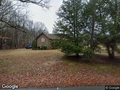
8313 S Pinson Dr White House, TN 37188
Estimated Value: $509,000 - $625,000
3
Beds
3
Baths
2,849
Sq Ft
$203/Sq Ft
Est. Value
About This Home
This home is located at 8313 S Pinson Dr, White House, TN 37188 and is currently estimated at $577,284, approximately $202 per square foot. 8313 S Pinson Dr is a home located in Robertson County with nearby schools including Robert F. Woodall Elementary School, White House Heritage Elementary School, and White House Heritage High School.
Ownership History
Date
Name
Owned For
Owner Type
Purchase Details
Closed on
Nov 22, 2019
Sold by
Woodard Sammy and Woodard Bonnie
Bought by
Mccarter Crystal and Safer Joseph Tyler
Current Estimated Value
Home Financials for this Owner
Home Financials are based on the most recent Mortgage that was taken out on this home.
Original Mortgage
$389,500
Interest Rate
3.6%
Mortgage Type
New Conventional
Purchase Details
Closed on
Mar 20, 2008
Sold by
Mcintyre Malcolm H
Bought by
Sammy Woodard
Home Financials for this Owner
Home Financials are based on the most recent Mortgage that was taken out on this home.
Original Mortgage
$230,000
Interest Rate
5.84%
Create a Home Valuation Report for This Property
The Home Valuation Report is an in-depth analysis detailing your home's value as well as a comparison with similar homes in the area
Home Values in the Area
Average Home Value in this Area
Purchase History
| Date | Buyer | Sale Price | Title Company |
|---|---|---|---|
| Mccarter Crystal | $410,000 | Warranty Title Ins Co Inc | |
| Sammy Woodard | $35,000 | -- |
Source: Public Records
Mortgage History
| Date | Status | Borrower | Loan Amount |
|---|---|---|---|
| Open | Mccarter Crystal | $390,000 | |
| Closed | Mccarter Crystal | $389,500 | |
| Previous Owner | Woodard Sammy | $210,000 | |
| Previous Owner | Woodard Sammy | $149,000 | |
| Previous Owner | Woodard Sammy | $197,000 | |
| Previous Owner | Sammy Woodard | $230,000 |
Source: Public Records
Tax History Compared to Growth
Tax History
| Year | Tax Paid | Tax Assessment Tax Assessment Total Assessment is a certain percentage of the fair market value that is determined by local assessors to be the total taxable value of land and additions on the property. | Land | Improvement |
|---|---|---|---|---|
| 2024 | $2,193 | $121,850 | $15,000 | $106,850 |
| 2023 | $2,193 | $121,850 | $15,000 | $106,850 |
| 2022 | $2,311 | $89,700 | $8,625 | $81,075 |
| 2021 | $2,311 | $89,700 | $8,625 | $81,075 |
| 2020 | $2,311 | $89,700 | $8,625 | $81,075 |
| 2019 | $2,042 | $79,275 | $8,625 | $70,650 |
| 2018 | $2,042 | $79,275 | $8,625 | $70,650 |
| 2017 | $2,028 | $65,725 | $6,925 | $58,800 |
| 2016 | $2,028 | $65,725 | $6,925 | $58,800 |
| 2015 | $1,945 | $65,725 | $6,925 | $58,800 |
| 2014 | $1,945 | $65,725 | $6,925 | $58,800 |
Source: Public Records
Map
Nearby Homes
- 0 S Pinson Dr
- 5112 Owens Ln
- 5200 Owens Ln
- 8266 Jesse Way
- 3347 Pleasant Grove Rd
- 7239 Sunny Parks Dr
- 7210 Scotlyn Way
- 4060 Crossing Way
- 8054 Typhani Way
- 5330 Owens Ln
- 1477 Rosewood Dr
- 4043 Beach Way
- 4100 Roane Dr
- 4077 Roane Dr
- 4070 Roane Dr
- 4063 Roane Dr
- 4056 Roane Dr
- 4047 Roane Dr
- 4046 Roane Dr
- 4038 Roane Dr