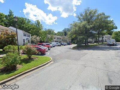
8337 Snowden Oaks Place Laurel, MD 20708
South Laurel NeighborhoodEstimated Value: $344,000 - $412,000
--
Bed
4
Baths
1,300
Sq Ft
$289/Sq Ft
Est. Value
About This Home
This home is located at 8337 Snowden Oaks Place, Laurel, MD 20708 and is currently estimated at $375,136, approximately $288 per square foot. 8337 Snowden Oaks Place is a home located in Prince George's County with nearby schools including James H. Harrison Elementary School, Dwight D. Eisenhower Middle School, and Laurel High School.
Ownership History
Date
Name
Owned For
Owner Type
Purchase Details
Closed on
Oct 24, 2023
Sold by
Maldonado Abelina
Bought by
Abelina Maldonado Living Trust and Maldonado
Current Estimated Value
Purchase Details
Closed on
Apr 29, 2004
Sold by
Burley Valerie L
Bought by
Maldonado Abelina
Purchase Details
Closed on
Mar 24, 2004
Sold by
Burley Valerie L
Bought by
Maldonado Abelina
Purchase Details
Closed on
Apr 12, 2000
Sold by
Snow Brian D
Bought by
Burley Valerie L
Purchase Details
Closed on
Jul 23, 1976
Sold by
K R B Inc
Bought by
Snow Brian D and Snow Myra
Create a Home Valuation Report for This Property
The Home Valuation Report is an in-depth analysis detailing your home's value as well as a comparison with similar homes in the area
Home Values in the Area
Average Home Value in this Area
Purchase History
| Date | Buyer | Sale Price | Title Company |
|---|---|---|---|
| Abelina Maldonado Living Trust | -- | None Listed On Document | |
| Maldonado Abelina | $189,000 | -- | |
| Maldonado Abelina | $189,000 | -- | |
| Burley Valerie L | $117,000 | -- | |
| Snow Brian D | $47,000 | -- |
Source: Public Records
Mortgage History
| Date | Status | Borrower | Loan Amount |
|---|---|---|---|
| Previous Owner | Maldonado Abelina | $180,000 | |
| Previous Owner | Maldonado Abelina | $158,300 | |
| Previous Owner | Maldonado Abelina | $195,123 | |
| Previous Owner | Maldonado Abelina | $199,600 |
Source: Public Records
Tax History Compared to Growth
Tax History
| Year | Tax Paid | Tax Assessment Tax Assessment Total Assessment is a certain percentage of the fair market value that is determined by local assessors to be the total taxable value of land and additions on the property. | Land | Improvement |
|---|---|---|---|---|
| 2024 | $3,757 | $298,333 | $0 | $0 |
| 2023 | $3,628 | $283,667 | $0 | $0 |
| 2022 | $3,469 | $269,000 | $75,000 | $194,000 |
| 2021 | $3,326 | $257,100 | $0 | $0 |
| 2020 | $3,252 | $245,200 | $0 | $0 |
| 2019 | $3,161 | $233,300 | $100,000 | $133,300 |
| 2018 | $3,042 | $218,600 | $0 | $0 |
| 2017 | $2,939 | $203,900 | $0 | $0 |
| 2016 | -- | $189,200 | $0 | $0 |
| 2015 | $2,549 | $186,967 | $0 | $0 |
| 2014 | $2,549 | $184,733 | $0 | $0 |
Source: Public Records
Map
Nearby Homes
- 8339 Snowden Oaks Place
- 0 Larchdale Rd Unit MDPG2054450
- 8366 Imperial Dr
- 13105 Imperial Ct
- 8705 Graystone Ln
- 8812 Churchfield Ln
- 7602 Whethersfield Place
- 12914 Rustic Rock Ln
- 12702 Cedarbrook Ln
- 13403 Briarwood Dr
- 13407 Kiama Ct
- 12515 Rustic Rock Ln
- 12308 Mount Pleasant Dr
- 12526 Adobe Alley
- 7230 Brickyard Station Dr
- 9208 Twin Hill Ln
- 7108 Rowlock Alley
- 12412 Mount Pleasant Dr
- 9204 Pleasant Ct
- 12016 Montague Dr
