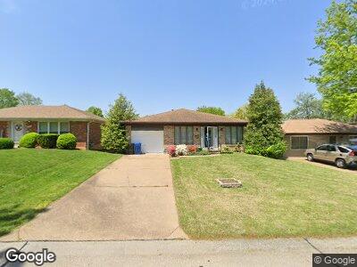
8361 Lonkar Dr Saint Louis, MO 63123
Affton NeighborhoodEstimated Value: $167,000 - $315,154
3
Beds
2
Baths
1,711
Sq Ft
$156/Sq Ft
Est. Value
About This Home
This home is located at 8361 Lonkar Dr, Saint Louis, MO 63123 and is currently estimated at $267,289, approximately $156 per square foot. 8361 Lonkar Dr is a home located in St. Louis County with nearby schools including Mesnier Primary School, Gotsch Intermediate School, and Rogers Middle School.
Ownership History
Date
Name
Owned For
Owner Type
Purchase Details
Closed on
Mar 29, 2023
Sold by
Relich Melanie
Bought by
Posey Brian Kelley and Posey Georgia
Current Estimated Value
Home Financials for this Owner
Home Financials are based on the most recent Mortgage that was taken out on this home.
Original Mortgage
$60,000
Outstanding Balance
$55,783
Interest Rate
5.64%
Mortgage Type
Credit Line Revolving
Estimated Equity
$231,045
Purchase Details
Closed on
Feb 2, 2023
Sold by
Relich George D
Bought by
Posey Georgia
Purchase Details
Closed on
Jul 7, 1997
Sold by
Relich George D and Relich Nada
Bought by
Relich Georgia and Puhar Melanie
Create a Home Valuation Report for This Property
The Home Valuation Report is an in-depth analysis detailing your home's value as well as a comparison with similar homes in the area
Home Values in the Area
Average Home Value in this Area
Purchase History
| Date | Buyer | Sale Price | Title Company |
|---|---|---|---|
| Posey Brian Kelley | -- | Investors Title Company | |
| Relich Georgia | -- | -- |
Source: Public Records
Mortgage History
| Date | Status | Borrower | Loan Amount |
|---|---|---|---|
| Open | Posey Georgia | $60,000 |
Source: Public Records
Tax History Compared to Growth
Tax History
| Year | Tax Paid | Tax Assessment Tax Assessment Total Assessment is a certain percentage of the fair market value that is determined by local assessors to be the total taxable value of land and additions on the property. | Land | Improvement |
|---|---|---|---|---|
| 2023 | $3,897 | $50,100 | $9,690 | $40,410 |
| 2022 | $3,625 | $42,430 | $9,690 | $32,740 |
| 2021 | $3,540 | $42,430 | $9,690 | $32,740 |
| 2020 | $3,448 | $38,560 | $9,600 | $28,960 |
| 2019 | $3,441 | $38,560 | $9,600 | $28,960 |
| 2018 | $3,386 | $33,540 | $6,710 | $26,830 |
| 2017 | $3,365 | $33,540 | $6,710 | $26,830 |
| 2016 | $2,893 | $30,630 | $5,000 | $25,630 |
| 2015 | $2,907 | $30,630 | $5,000 | $25,630 |
| 2014 | $3,105 | $32,610 | $7,090 | $25,520 |
Source: Public Records
Map
Nearby Homes
- 8306 Maylor Dr
- 8038 Mackenzie Rd
- 8019 Gramond Dr
- 5615 Willard Ave
- 9225 Pavia Ave
- 6215 Weber Rd
- 8454 Hampstead Dr
- 8331 Acorn Ave
- 7920 Harlan Ave
- 8518 Kathleen Ave
- 5220 Lakewood Ave
- 5212 Vine Ave
- 8506 Philo Ave
- 5121 Weber Rd
- 8700 Gravois Rd
- 9018 Kathleen Ave
- 5122 Hilda Ave
- 8805 Ivy Ave
- 9401 Daisy Ln
- 7813 Elton St