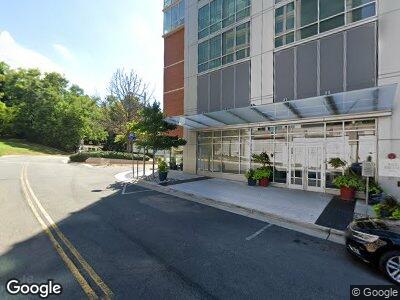
8421 Broad St McLean, VA 22102
Tysons Corner NeighborhoodEstimated Value: $1,044,000
--
Bed
--
Bath
416,834
Sq Ft
$3/Sq Ft
Est. Value
About This Home
This home is located at 8421 Broad St, McLean, VA 22102 and is currently priced at $1,044,000, approximately $2 per square foot. 8421 Broad St is a home located in Fairfax County with nearby schools including Spring Hill Elementary School, Longfellow Middle School, and McLean High School.
Ownership History
Date
Name
Owned For
Owner Type
Purchase Details
Closed on
Sep 21, 2021
Sold by
Gs Spring Hill Subsidiary Llc
Bought by
Oe Ascent Llc
Current Estimated Value
Home Financials for this Owner
Home Financials are based on the most recent Mortgage that was taken out on this home.
Original Mortgage
$83,700,000
Outstanding Balance
$77,639,358
Interest Rate
2.8%
Mortgage Type
Commercial
Create a Home Valuation Report for This Property
The Home Valuation Report is an in-depth analysis detailing your home's value as well as a comparison with similar homes in the area
Home Values in the Area
Average Home Value in this Area
Purchase History
| Date | Buyer | Sale Price | Title Company |
|---|---|---|---|
| Oe Ascent Llc | $150,500,000 | Chicago Title Insurance Co |
Source: Public Records
Mortgage History
| Date | Status | Borrower | Loan Amount |
|---|---|---|---|
| Open | Oe Ascent Llc | $83,700,000 | |
| Previous Owner | Gs Spring Hill Subsidiary Llc | $77,000,000 |
Source: Public Records
Tax History Compared to Growth
Tax History
| Year | Tax Paid | Tax Assessment Tax Assessment Total Assessment is a certain percentage of the fair market value that is determined by local assessors to be the total taxable value of land and additions on the property. | Land | Improvement |
|---|---|---|---|---|
| 2024 | $1,858,074 | $143,093,840 | $20,008,030 | $123,085,810 |
| 2023 | $1,807,058 | $142,456,260 | $20,008,030 | $122,448,230 |
| 2022 | $1,553,168 | $135,825,830 | $22,925,870 | $112,899,960 |
| 2021 | $1,616,011 | $123,030,890 | $22,925,870 | $100,105,020 |
| 2020 | $1,538,965 | $116,279,950 | $22,925,870 | $93,354,080 |
| 2019 | $1,506,567 | $112,137,450 | $22,925,870 | $89,211,580 |
| 2018 | $1,433,301 | $124,634,900 | $20,633,280 | $104,001,620 |
| 2017 | $1,707,427 | $125,453,820 | $21,758,730 | $103,695,090 |
| 2016 | $1,738,293 | $126,100,290 | $20,633,280 | $105,467,010 |
| 2015 | $1,655,777 | $122,107,470 | $20,633,280 | $101,474,190 |
| 2014 | -- | $0 | $0 | $0 |
Source: Public Records
Map
Nearby Homes
- 8370 Greensboro Dr Unit 525
- 8370 Greensboro Dr Unit 916
- 8370 Greensboro Dr Unit 1001
- 8370 Greensboro Dr Unit 203
- 8370 Greensboro Dr Unit 122
- 8370 Greensboro Dr Unit 301
- 8370 Greensboro Dr Unit 414
- 8360 Greensboro Dr Unit 802
- 8360 Greensboro Dr Unit 211
- 8360 Greensboro Dr Unit 721
- 8380 Greensboro Dr Unit 817
- 8380 Greensboro Dr Unit 210
- 8380 Greensboro Dr Unit 626
- 8350 Greensboro Dr Unit 707
- 8350 Greensboro Dr Unit 1008
- 8340 Greensboro Dr Unit 902
- 8340 Greensboro Dr Unit 112
- 8340 Greensboro Dr Unit 1010
- 1650 Silver Hill Dr Unit 1709
- 1650 Silver Hill Dr Unit 2309