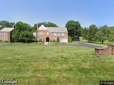
85 Terry Rd Hartford, CT 06105
West End NeighborhoodEstimated Value: $727,000 - $1,035,000
6
Beds
6
Baths
5,285
Sq Ft
$176/Sq Ft
Est. Value
About This Home
This home is located at 85 Terry Rd, Hartford, CT 06105 and is currently estimated at $931,628, approximately $176 per square foot. 85 Terry Rd is a home located in Hartford County with nearby schools including West Middle School, Rawson School, and Martin Luther King, Jr. Middle School.
Ownership History
Date
Name
Owned For
Owner Type
Purchase Details
Closed on
Apr 1, 2025
Sold by
Scully Patrick E
Bought by
Fairbanks Marri D and Fairbanks Jonathan M
Current Estimated Value
Purchase Details
Closed on
Feb 1, 2016
Sold by
Fairbanks Marri D
Bought by
Faribanks Marri D and Fairbanks Jonathan M
Home Financials for this Owner
Home Financials are based on the most recent Mortgage that was taken out on this home.
Original Mortgage
$465,000
Interest Rate
3.97%
Mortgage Type
Credit Line Revolving
Purchase Details
Closed on
Jan 20, 2004
Sold by
Strilkauskas Scott
Bought by
Fairbanks Marri
Purchase Details
Closed on
Dec 16, 2002
Sold by
Us Bk Na
Bought by
Barbieri Joseph
Create a Home Valuation Report for This Property
The Home Valuation Report is an in-depth analysis detailing your home's value as well as a comparison with similar homes in the area
Home Values in the Area
Average Home Value in this Area
Purchase History
| Date | Buyer | Sale Price | Title Company |
|---|---|---|---|
| Fairbanks Marri D | -- | None Available | |
| Fairbanks Marri D | -- | None Available | |
| Scully Patrick E | -- | None Available | |
| Scully Patrick E | -- | None Available | |
| Faribanks Marri D | -- | -- | |
| Faribanks Marri D | -- | -- | |
| Fairbanks Marri | $530,000 | -- | |
| Fairbanks Marri | $530,000 | -- | |
| Barbieri Joseph | $429,900 | -- |
Source: Public Records
Mortgage History
| Date | Status | Borrower | Loan Amount |
|---|---|---|---|
| Previous Owner | Allport Joan | $409,500 | |
| Previous Owner | Allport Joan | $465,000 |
Source: Public Records
Tax History Compared to Growth
Tax History
| Year | Tax Paid | Tax Assessment Tax Assessment Total Assessment is a certain percentage of the fair market value that is determined by local assessors to be the total taxable value of land and additions on the property. | Land | Improvement |
|---|---|---|---|---|
| 2024 | $17,991 | $260,925 | $84,635 | $176,290 |
| 2023 | $17,991 | $260,925 | $84,635 | $176,290 |
| 2022 | $17,991 | $260,925 | $84,635 | $176,290 |
| 2021 | $12,871 | $173,250 | $104,755 | $68,495 |
| 2020 | $12,871 | $173,250 | $104,755 | $68,495 |
| 2019 | $12,871 | $173,250 | $104,755 | $68,495 |
| 2018 | $12,437 | $167,409 | $101,223 | $66,186 |
| 2016 | $18,133 | $244,087 | $96,404 | $147,683 |
| 2015 | $17,272 | $232,493 | $91,825 | $140,668 |
| 2014 | $16,850 | $226,810 | $89,581 | $137,229 |
Source: Public Records
Map
Nearby Homes
- 165 Scarborough St
- 260 Terry Rd
- 141 Kenyon St
- 35 Bloomfield Ave
- 795 Prospect Ave Unit B-5
- 1443 Albany Ave
- 30 Stratford Rd
- 116 Baltimore St Unit 118
- 8 Bassette Ln
- 38 Birch Rd
- 17 Harrison Place Unit C
- 25 Cornwall St
- 31-33 Norfolk St
- 53 Blue Hills Ave
- 250 Homestead Ave
- 364 Woodland St
- 111 Westbourne Pkwy Unit 113
- 290 Sargeant St Unit 292
- 23-25 Sterling St
- 31 Woodland St Unit 8M