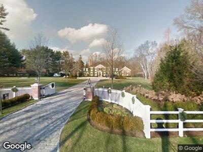
88 Half Mile Rd Darien, CT 06820
Darien NeighborhoodEstimated Value: $5,621,680 - $5,976,000
6
Beds
9
Baths
9,424
Sq Ft
$610/Sq Ft
Est. Value
About This Home
This home is located at 88 Half Mile Rd, Darien, CT 06820 and is currently estimated at $5,745,227, approximately $609 per square foot. 88 Half Mile Rd is a home located in Fairfield County with nearby schools including Ox Ridge Elementary School, Middlesex Middle School, and Darien High School.
Ownership History
Date
Name
Owned For
Owner Type
Purchase Details
Closed on
Jun 2, 2011
Sold by
Lancaster Neville J and Lancaster Whitney Y
Bought by
Fdl Properties Llc
Current Estimated Value
Home Financials for this Owner
Home Financials are based on the most recent Mortgage that was taken out on this home.
Original Mortgage
$3,938,000
Interest Rate
4.74%
Purchase Details
Closed on
Nov 16, 2007
Sold by
Macfarlane Dudley W
Bought by
Murray Robert E
Create a Home Valuation Report for This Property
The Home Valuation Report is an in-depth analysis detailing your home's value as well as a comparison with similar homes in the area
Home Values in the Area
Average Home Value in this Area
Purchase History
| Date | Buyer | Sale Price | Title Company |
|---|---|---|---|
| Fdl Properties Llc | -- | -- | |
| Murray Robert E | $7,500,000 | -- |
Source: Public Records
Mortgage History
| Date | Status | Borrower | Loan Amount |
|---|---|---|---|
| Open | Macfarlane John | $3,960,000 | |
| Closed | Macfarlane John | $3,938,000 | |
| Previous Owner | Macfarlane John | $4,133,540 |
Source: Public Records
Tax History Compared to Growth
Tax History
| Year | Tax Paid | Tax Assessment Tax Assessment Total Assessment is a certain percentage of the fair market value that is determined by local assessors to be the total taxable value of land and additions on the property. | Land | Improvement |
|---|---|---|---|---|
| 2024 | $52,803 | $3,594,500 | $1,288,490 | $2,306,010 |
| 2023 | $56,761 | $3,223,220 | $858,970 | $2,364,250 |
| 2022 | $55,536 | $3,223,220 | $858,970 | $2,364,250 |
| 2021 | $12,042 | $3,223,220 | $858,970 | $2,364,250 |
| 2020 | $52,732 | $3,223,220 | $858,970 | $2,364,250 |
| 2019 | $51,325 | $3,116,260 | $858,970 | $2,257,290 |
| 2018 | $58,531 | $3,640,000 | $920,360 | $2,719,640 |
| 2017 | $58,822 | $3,640,000 | $920,360 | $2,719,640 |
| 2016 | $57,403 | $3,640,000 | $920,360 | $2,719,640 |
| 2015 | $61,018 | $3,975,090 | $920,360 | $3,054,730 |
| 2014 | $60,181 | $4,009,390 | $920,360 | $3,089,030 |
Source: Public Records
Map
Nearby Homes
- 660 Hollow Tree Ridge Rd
- 865 Hollow Tree Ridge Rd
- 520 Hoyt St
- 6 Pilgrim Rd
- 15 Allwood Rd
- 48 Dorchester Rd
- 22 Charter Oak Dr
- 276 Mansfield Ave
- 55 Jelliff Mill Rd Unit 55
- 112 Camp Ave
- 26 Peach Hill Rd
- 20 Marianne Rd
- 139 Jelliff Mill Rd
- 13 Ridgeview Ave
- 37 Columbus Place Unit 2
- 225 Hoyt St
- 217 W Norwalk Rd
- 14 Overlook Place
- 32 Old Oak Rd
- 362 Hollow Tree Ridge Rd