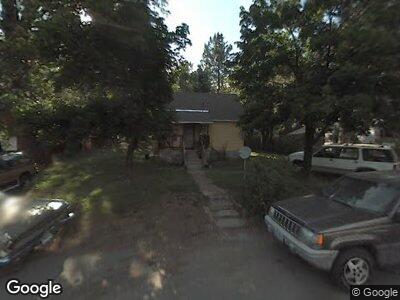
901 Hill St McCloud, CA 96057
Estimated Value: $133,000 - $235,000
1
Bed
1
Bath
552
Sq Ft
$340/Sq Ft
Est. Value
About This Home
Rustic cabin on the edge of town, backs up to forestland. Large yard, quiet street, small pets considered
Rare McCloud rental, Text for more info,
Ownership History
Date
Name
Owned For
Owner Type
Purchase Details
Closed on
Mar 13, 2018
Sold by
Lanham Sara B and Lanham Sara
Bought by
Lanham Sara B
Current Estimated Value
Purchase Details
Closed on
Jul 17, 2002
Sold by
Tallerico Louie Nick and Tallerico Diana M
Bought by
Lanham Sara
Home Financials for this Owner
Home Financials are based on the most recent Mortgage that was taken out on this home.
Original Mortgage
$40,000
Outstanding Balance
$18,096
Interest Rate
6.6%
Mortgage Type
Seller Take Back
Estimated Equity
$169,370
Create a Home Valuation Report for This Property
The Home Valuation Report is an in-depth analysis detailing your home's value as well as a comparison with similar homes in the area
Home Values in the Area
Average Home Value in this Area
Purchase History
| Date | Buyer | Sale Price | Title Company |
|---|---|---|---|
| Lanham Sara B | -- | None Available | |
| Lanham Sara | $58,000 | -- |
Source: Public Records
Mortgage History
| Date | Status | Borrower | Loan Amount |
|---|---|---|---|
| Open | Lanham Sara | $40,000 |
Source: Public Records
Property History
| Date | Event | Price | Change | Sq Ft Price |
|---|---|---|---|---|
| 04/15/2025 04/15/25 | Off Market | $950 | -- | -- |
| 03/13/2025 03/13/25 | For Rent | $950 | 0.0% | -- |
| 11/21/2024 11/21/24 | Off Market | $950 | -- | -- |
| 10/18/2024 10/18/24 | For Rent | $950 | -- | -- |
Tax History Compared to Growth
Tax History
| Year | Tax Paid | Tax Assessment Tax Assessment Total Assessment is a certain percentage of the fair market value that is determined by local assessors to be the total taxable value of land and additions on the property. | Land | Improvement |
|---|---|---|---|---|
| 2023 | $1,153 | $80,718 | $33,399 | $47,319 |
| 2022 | $1,119 | $79,137 | $32,745 | $46,392 |
| 2021 | $1,105 | $77,586 | $32,103 | $45,483 |
| 2020 | $1,099 | $76,791 | $31,774 | $45,017 |
| 2019 | $1,082 | $75,286 | $31,151 | $44,135 |
| 2018 | $1,067 | $73,811 | $30,541 | $43,270 |
| 2017 | $1,053 | $72,365 | $29,943 | $42,422 |
| 2016 | $1,038 | $70,947 | $29,356 | $41,591 |
| 2015 | -- | $69,883 | $28,916 | $40,967 |
| 2014 | -- | $68,515 | $28,350 | $40,165 |
Source: Public Records
Map
Nearby Homes
- 708 Hennessy Way
- 824 Quail Ct
- 0 W Colombero Dr
- 561 Quincy Ave
- 729 Dogwood Ln
- 521 Wetzel Dr
- 521 Broadway Ave
- 400 Quincy Ave
- 10 Parkside Ct
- 9 Parkside Ct
- 429 Shasta Ave
- 429 Grove Ave
- 110 Squaw Valley Rd
- 47 Panther Meadow Dr
- 46 Panther Meadow Dr
- 45 Panther Meadow Dr
- 43 Panther Meadow Dr
- 44 Panther Meadow Dr
- 42 Panther Meadow Dr
- 41 Panther Meadow Dr