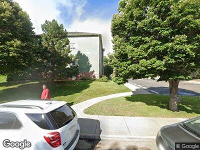
9189 Gale Blvd Thornton, CO 80260
South Thornton NeighborhoodEstimated Value: $32,519,005
537
Beds
272
Baths
232,392
Sq Ft
$140/Sq Ft
Est. Value
About This Home
This home is located at 9189 Gale Blvd, Thornton, CO 80260 and is currently estimated at $32,519,005, approximately $139 per square foot. 9189 Gale Blvd is a home located in Adams County with nearby schools including North Star Elementary School, Thornton Middle School, and Northglenn High School.
Ownership History
Date
Name
Owned For
Owner Type
Purchase Details
Closed on
Jul 21, 2011
Sold by
New Vision Housing Partners Lp
Bought by
Creekside Operating Llc
Current Estimated Value
Home Financials for this Owner
Home Financials are based on the most recent Mortgage that was taken out on this home.
Original Mortgage
$8,270,300
Outstanding Balance
$5,864,581
Interest Rate
4.56%
Mortgage Type
Commercial
Estimated Equity
$26,795,586
Create a Home Valuation Report for This Property
The Home Valuation Report is an in-depth analysis detailing your home's value as well as a comparison with similar homes in the area
Home Values in the Area
Average Home Value in this Area
Purchase History
| Date | Buyer | Sale Price | Title Company |
|---|---|---|---|
| Creekside Operating Llc | $14,432,800 | Stewart Title |
Source: Public Records
Mortgage History
| Date | Status | Borrower | Loan Amount |
|---|---|---|---|
| Open | New Vision Housing Partners Lp | $8,270,300 |
Source: Public Records
Tax History Compared to Growth
Tax History
| Year | Tax Paid | Tax Assessment Tax Assessment Total Assessment is a certain percentage of the fair market value that is determined by local assessors to be the total taxable value of land and additions on the property. | Land | Improvement |
|---|---|---|---|---|
| 2024 | -- | $3,515,790 | $279,660 | $3,236,130 |
| 2023 | -- | $3,805,480 | $302,700 | $3,502,780 |
| 2022 | $0 | $3,820,710 | $304,260 | $3,516,450 |
| 2021 | $582,871 | $3,820,710 | $304,260 | $3,516,450 |
| 2020 | $370,149 | $3,172,070 | $1,297,600 | $1,874,470 |
| 2019 | $0 | $3,172,070 | $1,297,600 | $1,874,470 |
| 2018 | $0 | $2,209,740 | $322,160 | $1,887,580 |
| 2017 | $0 | $2,168,570 | $322,160 | $1,846,410 |
| 2016 | -- | $2,185,590 | $356,170 | $1,829,420 |
| 2015 | -- | $2,185,590 | $356,170 | $1,829,420 |
| 2014 | -- | $1,493,220 | $178,080 | $1,315,140 |
Source: Public Records
Map
Nearby Homes
- 9032 Gale Blvd Unit 1
- 9126 Gale Blvd Unit 2
- 1500 W Thornton Pkwy Unit 11
- 1500 W Thornton Pkwy Unit 111
- 1500 W Thornton Pkwy Unit 118
- 1500 W Thornton Pkwy Unit 104
- 1500 W Thornton Pkwy Unit 163
- 1500 W Thornton Pkwy Unit 367
- 8976 Fox Dr Unit 101
- 8976 Fox Dr Unit 1102
- 6739 Juniper Dr
- 6719 Juniper Dr
- 6709 Juniper Dr
- 6750 Juniper Dr
- 6729 Juniper Dr
- 6689 Juniper Dr
- 6679 Juniper Dr
- 6669 Juniper Dr
- 6699 Juniper Dr
- 1383 W 88th Ave Unit 307