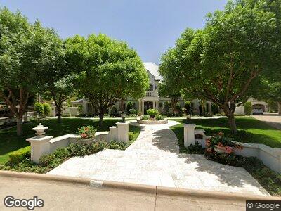
919 Alta Loma Cir San Angelo, TX 76901
Santa Rita NeighborhoodEstimated Value: $403,000 - $1,888,397
4
Beds
5
Baths
5,452
Sq Ft
$210/Sq Ft
Est. Value
About This Home
This home is located at 919 Alta Loma Cir, San Angelo, TX 76901 and is currently estimated at $1,145,699, approximately $210 per square foot. 919 Alta Loma Cir is a home located in Tom Green County with nearby schools including Santa Rita Elementary School, Lone Star Middle School, and Central High School.
Ownership History
Date
Name
Owned For
Owner Type
Purchase Details
Closed on
May 9, 2008
Sold by
Schkade Sandra B and Gene Schkade L
Bought by
Bates Devin Lee and Bates Elizabeth Dawn
Current Estimated Value
Purchase Details
Closed on
Feb 13, 2007
Sold by
Collins Cal
Bought by
Bates Devin Lee and Elizabeth Dawn
Purchase Details
Closed on
Oct 5, 2006
Sold by
Ball La Verne - Deceased
Bought by
Bates Devin Lee and Elizabeth Dawn
Purchase Details
Closed on
Jul 27, 2001
Sold by
Ball Fred - Deceased
Bought by
Bates Devin Lee and Elizabeth Dawn
Create a Home Valuation Report for This Property
The Home Valuation Report is an in-depth analysis detailing your home's value as well as a comparison with similar homes in the area
Home Values in the Area
Average Home Value in this Area
Purchase History
| Date | Buyer | Sale Price | Title Company |
|---|---|---|---|
| Bates Devin Lee | -- | None Available | |
| Bates Devin Lee | -- | -- | |
| Bates Devin Lee | -- | -- | |
| Bates Devin Lee | -- | -- |
Source: Public Records
Tax History Compared to Growth
Tax History
| Year | Tax Paid | Tax Assessment Tax Assessment Total Assessment is a certain percentage of the fair market value that is determined by local assessors to be the total taxable value of land and additions on the property. | Land | Improvement |
|---|---|---|---|---|
| 2024 | $34,234 | $1,998,090 | $97,240 | $1,900,850 |
| 2023 | $32,085 | $1,875,550 | $31,720 | $1,843,830 |
| 2022 | $46,917 | $2,117,410 | $99,490 | $2,017,920 |
| 2021 | $48,480 | $1,999,680 | $0 | $0 |
| 2020 | $49,136 | $1,999,680 | $99,490 | $1,900,190 |
| 2019 | $50,612 | $1,999,680 | $99,490 | $1,900,190 |
| 2018 | $50,870 | $2,017,860 | $99,490 | $1,918,370 |
| 2017 | $52,218 | $2,081,630 | $99,490 | $1,982,140 |
| 2016 | $50,811 | $2,025,540 | $43,400 | $1,982,140 |
| 2015 | $45,471 | $2,020,480 | $43,400 | $1,977,080 |
| 2014 | $46,113 | $2,020,480 | $43,400 | $1,977,080 |
| 2013 | $41,904 | $1,829,500 | $0 | $0 |
Source: Public Records
Map
Nearby Homes
- 1411 Kenwood Dr
- 1428 Mackenzie St
- 1414 Paseo de Vaca St
- 1310 Austin St
- 1325 S David St
- 515 W Avenue I
- 1420 S David St
- 418 S Adams St
- N/A Bryant Blvd Unit 1-5
- 800 W Avenue D
- 1210 S Abe St
- 610 W Avenue L
- 1523 S David St
- 1306 S Monroe St
- 1322 S Monroe St
- 1705 Kenwood Dr
- 309 S Washington St
- 1726 S Park St
- 1314 S Jackson St
- 1511 S Monroe St