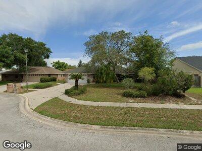
920 Brookshire Cir Malabar, FL 32950
Malabar NeighborhoodEstimated Value: $384,234 - $441,000
3
Beds
2
Baths
1,750
Sq Ft
$234/Sq Ft
Est. Value
About This Home
This home is located at 920 Brookshire Cir, Malabar, FL 32950 and is currently estimated at $410,059, approximately $234 per square foot. 920 Brookshire Cir is a home located in Brevard County with nearby schools including Port Malabar Elementary School, Stone Magnet Middle School, and Palm Bay Magnet Senior High School.
Ownership History
Date
Name
Owned For
Owner Type
Purchase Details
Closed on
May 25, 1995
Sold by
Caponi Florence Barbara and Kaluzny Florence B
Bought by
Burns James K and Burns Michelle
Current Estimated Value
Home Financials for this Owner
Home Financials are based on the most recent Mortgage that was taken out on this home.
Original Mortgage
$120,600
Interest Rate
8.35%
Create a Home Valuation Report for This Property
The Home Valuation Report is an in-depth analysis detailing your home's value as well as a comparison with similar homes in the area
Home Values in the Area
Average Home Value in this Area
Purchase History
| Date | Buyer | Sale Price | Title Company |
|---|---|---|---|
| Burns James K | $134,000 | -- |
Source: Public Records
Mortgage History
| Date | Status | Borrower | Loan Amount |
|---|---|---|---|
| Open | Burns James K | $109,000 | |
| Closed | Burns James K | $12,000 | |
| Closed | Burns James K | $140,000 | |
| Closed | Burns James K | $20,000 | |
| Closed | Burns James K | $120,600 |
Source: Public Records
Tax History Compared to Growth
Tax History
| Year | Tax Paid | Tax Assessment Tax Assessment Total Assessment is a certain percentage of the fair market value that is determined by local assessors to be the total taxable value of land and additions on the property. | Land | Improvement |
|---|---|---|---|---|
| 2023 | $1,830 | $149,520 | $0 | $0 |
| 2022 | $1,683 | $145,170 | $0 | $0 |
| 2021 | $1,514 | $140,950 | $0 | $0 |
| 2020 | $1,506 | $139,010 | $0 | $0 |
| 2019 | $1,480 | $135,890 | $0 | $0 |
| 2018 | $1,471 | $133,360 | $0 | $0 |
| 2017 | $1,480 | $130,620 | $0 | $0 |
| 2016 | $1,486 | $127,940 | $20,000 | $107,940 |
| 2015 | $1,524 | $127,060 | $15,000 | $112,060 |
| 2014 | $1,521 | $126,060 | $28,000 | $98,060 |
Source: Public Records
Map
Nearby Homes
- 1130 Hollow Brook Ln
- 930 Holloway Trail
- 581 Drexel Ave NE
- 635 Cayuga Ave NE
- 2270 Kent St NE
- 575 Bounty Ave NE
- 438 Minor Ave NE
- 711 Cayuga Ave NE
- 872 Sadnet Cir NE
- 2173 Tangle St NE
- 771 Cayuga Ave NE
- 2264 Ladner Rd NE
- 2160 Algeria St NE
- 2445 Fallon Blvd NE
- 2351 Hidden Pine Ln NE
- 1382 Knave Ln
- 751 Burman Ln NE
- 2113 Greyfield St NE
- 2107 Fallon Blvd NE
- 2163 Advana St NE