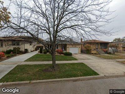
9321 Major Ave Oak Lawn, IL 60453
Estimated Value: $307,635 - $390,000
4
Beds
2
Baths
1,720
Sq Ft
$203/Sq Ft
Est. Value
About This Home
This home is located at 9321 Major Ave, Oak Lawn, IL 60453 and is currently estimated at $348,409, approximately $202 per square foot. 9321 Major Ave is a home located in Cook County with nearby schools including Harnew Elementary School, Simmons Middle School, and Oak Lawn Community High School.
Ownership History
Date
Name
Owned For
Owner Type
Purchase Details
Closed on
Jul 11, 2017
Sold by
Laskowski Erwin J and Laskowski Ruth D
Bought by
Laskowski Erwin J and Erwin J Laskowski Jr And Ruth D Laskowsk
Current Estimated Value
Purchase Details
Closed on
Oct 29, 1997
Sold by
First National Bank Of Evergreen Park
Bought by
Laskowski Erwin J and Laskowski Ruth D
Home Financials for this Owner
Home Financials are based on the most recent Mortgage that was taken out on this home.
Original Mortgage
$40,000
Outstanding Balance
$7,826
Interest Rate
7.45%
Mortgage Type
Seller Take Back
Estimated Equity
$340,583
Create a Home Valuation Report for This Property
The Home Valuation Report is an in-depth analysis detailing your home's value as well as a comparison with similar homes in the area
Home Values in the Area
Average Home Value in this Area
Purchase History
| Date | Buyer | Sale Price | Title Company |
|---|---|---|---|
| Laskowski Erwin J | -- | None Available | |
| Laskowski Erwin J | $160,000 | -- |
Source: Public Records
Mortgage History
| Date | Status | Borrower | Loan Amount |
|---|---|---|---|
| Open | Laskowski Erwin J | $40,000 | |
| Previous Owner | First National Bank Of Evergreen Park | $132,700 |
Source: Public Records
Tax History Compared to Growth
Tax History
| Year | Tax Paid | Tax Assessment Tax Assessment Total Assessment is a certain percentage of the fair market value that is determined by local assessors to be the total taxable value of land and additions on the property. | Land | Improvement |
|---|---|---|---|---|
| 2024 | $4,644 | $28,001 | $3,853 | $24,148 |
| 2023 | $4,644 | $28,001 | $3,853 | $24,148 |
| 2022 | $4,644 | $19,379 | $3,350 | $16,029 |
| 2021 | $4,555 | $19,378 | $3,350 | $16,028 |
| 2020 | $4,600 | $19,378 | $3,350 | $16,028 |
| 2019 | $4,688 | $20,611 | $3,015 | $17,596 |
| 2018 | $4,489 | $20,611 | $3,015 | $17,596 |
| 2017 | $4,586 | $20,611 | $3,015 | $17,596 |
| 2016 | $4,600 | $17,982 | $2,512 | $15,470 |
| 2015 | $4,493 | $17,982 | $2,512 | $15,470 |
| 2014 | $4,484 | $17,982 | $2,512 | $15,470 |
| 2013 | $4,786 | $20,422 | $2,512 | $17,910 |
Source: Public Records
Map
Nearby Homes
- 9533 Massasoit Ave
- 9220 S 54th Ct
- 9516 W Shore Dr
- 9624 W Shore Dr
- 5509 Otto Place
- 9545 Southwest Hwy Unit 1E
- 5833 W 90th St
- 5368 W 96th St Unit 2S
- 9629 Mason Ave
- 5429 Edison Ave
- 9609 S Austin Ave Unit 3
- 9315 Meade Ave
- 9740 Parkside Ave
- 8918 Central Ave
- 6101 W 94th St Unit A8
- 5321 Otto Place
- 9329 Moody Ave
- 5827 W 89th St
- 5304 Franklin Ave
- 9137 Moody Ave