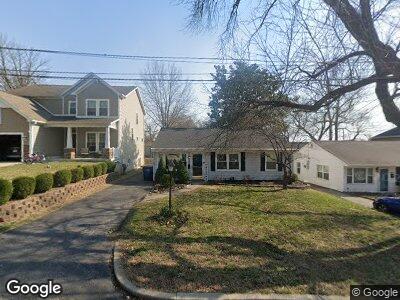
9334 Berry Ave Saint Louis, MO 63144
Rock Hill NeighborhoodEstimated Value: $233,637 - $324,000
3
Beds
1
Bath
1,008
Sq Ft
$281/Sq Ft
Est. Value
About This Home
This home is located at 9334 Berry Ave, Saint Louis, MO 63144 and is currently estimated at $283,659, approximately $281 per square foot. 9334 Berry Ave is a home located in St. Louis County with nearby schools including Hudson Elementary School, Hixson Middle School, and Webster Groves High School.
Ownership History
Date
Name
Owned For
Owner Type
Purchase Details
Closed on
Oct 5, 2015
Sold by
Oberle Kyle and Oberle Rebecca
Bought by
Kreb Investments Llc
Current Estimated Value
Purchase Details
Closed on
Jun 13, 2005
Sold by
Le Julia R and Le Steven
Bought by
Oberle Kyle
Home Financials for this Owner
Home Financials are based on the most recent Mortgage that was taken out on this home.
Original Mortgage
$20,925
Interest Rate
5.33%
Mortgage Type
Stand Alone Second
Purchase Details
Closed on
Nov 1, 1999
Sold by
Michael Coffey R and Michael J H
Bought by
Rice Julie B
Home Financials for this Owner
Home Financials are based on the most recent Mortgage that was taken out on this home.
Original Mortgage
$63,200
Interest Rate
7.77%
Create a Home Valuation Report for This Property
The Home Valuation Report is an in-depth analysis detailing your home's value as well as a comparison with similar homes in the area
Home Values in the Area
Average Home Value in this Area
Purchase History
| Date | Buyer | Sale Price | Title Company |
|---|---|---|---|
| Kreb Investments Llc | $145,000 | Us Title Ladue | |
| Oberle Kyle | $139,500 | -- | |
| Rice Julie B | $79,000 | -- |
Source: Public Records
Mortgage History
| Date | Status | Borrower | Loan Amount |
|---|---|---|---|
| Previous Owner | Oberle | $124,800 | |
| Previous Owner | Oberle Kyle | $20,925 | |
| Previous Owner | Oberle Kyle | $111,600 | |
| Previous Owner | Rice Julie B | $63,200 |
Source: Public Records
Tax History Compared to Growth
Tax History
| Year | Tax Paid | Tax Assessment Tax Assessment Total Assessment is a certain percentage of the fair market value that is determined by local assessors to be the total taxable value of land and additions on the property. | Land | Improvement |
|---|---|---|---|---|
| 2023 | $2,894 | $39,640 | $27,800 | $11,840 |
| 2022 | $2,532 | $32,340 | $24,680 | $7,660 |
| 2021 | $2,516 | $32,340 | $24,680 | $7,660 |
| 2020 | $2,543 | $31,250 | $21,620 | $9,630 |
| 2019 | $2,528 | $31,250 | $21,620 | $9,630 |
| 2018 | $2,443 | $26,530 | $14,520 | $12,010 |
| 2017 | $2,432 | $26,530 | $14,520 | $12,010 |
| 2016 | $2,146 | $22,310 | $11,650 | $10,660 |
| 2015 | $2,070 | $22,310 | $11,650 | $10,660 |
| 2014 | $2,505 | $26,360 | $10,490 | $15,870 |
Source: Public Records
Map
Nearby Homes
- 9324 Crawford Ave
- 9237 Merritt Ave
- 9239 Merritt Ave
- 9235 Merritt Ave
- 9227 Merritt Ave
- 2516 Pocahontas Place
- 2423 Rockford Ave
- 2437 Pocahontas Place
- 1048 Charleville Ave
- 9110 Madge Ave
- 9305 Litzsinger Rd
- 1035 N Rock Hill Rd
- 1033 N Rock Hill Rd
- 2827 Dunkirk Dr
- 2821 Manderly Dr
- 1247 Charlane Ct
- 2820 Manderly Dr
- 9717 Graystone Terrace
- 2904 Collier Ave
- 9549 Plainfield Dr