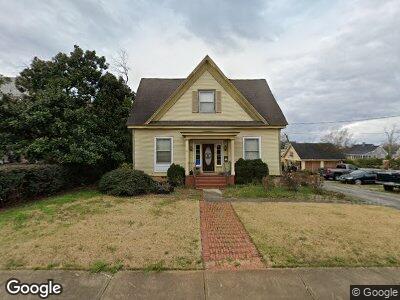
95 Greenville St Newnan, GA 30263
Greenville-Lagrange NeighborhoodEstimated Value: $543,000 - $705,000
3
Beds
2
Baths
3,588
Sq Ft
$165/Sq Ft
Est. Value
About This Home
This home is located at 95 Greenville St, Newnan, GA 30263 and is currently estimated at $593,484, approximately $165 per square foot. 95 Greenville St is a home located in Coweta County with nearby schools including Atkinson Elementary School, Smokey Road Middle School, and Newnan High School.
Ownership History
Date
Name
Owned For
Owner Type
Purchase Details
Closed on
Feb 16, 1998
Sold by
Griffith Rosemary R
Bought by
Morgan L Leigh
Current Estimated Value
Home Financials for this Owner
Home Financials are based on the most recent Mortgage that was taken out on this home.
Original Mortgage
$119,400
Interest Rate
6.89%
Mortgage Type
New Conventional
Purchase Details
Closed on
Dec 25, 1976
Bought by
Griffith Rosemary R
Create a Home Valuation Report for This Property
The Home Valuation Report is an in-depth analysis detailing your home's value as well as a comparison with similar homes in the area
Home Values in the Area
Average Home Value in this Area
Purchase History
| Date | Buyer | Sale Price | Title Company |
|---|---|---|---|
| Morgan L Leigh | $135,900 | -- | |
| Griffith Rosemary R | -- | -- |
Source: Public Records
Mortgage History
| Date | Status | Borrower | Loan Amount |
|---|---|---|---|
| Open | Morgan L Leigh | $166,000 | |
| Closed | Morgan Luther L | $110,000 | |
| Closed | Morgan L Leigh | $25,000 | |
| Closed | Morgan L Leigh | $117,400 | |
| Closed | Morgan L Leigh | $119,400 |
Source: Public Records
Tax History Compared to Growth
Tax History
| Year | Tax Paid | Tax Assessment Tax Assessment Total Assessment is a certain percentage of the fair market value that is determined by local assessors to be the total taxable value of land and additions on the property. | Land | Improvement |
|---|---|---|---|---|
| 2023 | $3,576 | $145,219 | $50,700 | $94,519 |
| 2022 | $3,392 | $142,880 | $50,700 | $92,180 |
| 2021 | $3,289 | $125,941 | $50,700 | $75,241 |
| 2020 | $3,361 | $125,941 | $50,700 | $75,241 |
| 2019 | $2,860 | $98,925 | $24,327 | $74,598 |
| 2018 | $2,876 | $98,925 | $24,327 | $74,598 |
| 2017 | $2,758 | $95,423 | $24,326 | $71,097 |
| 2016 | $2,761 | $95,423 | $24,327 | $71,096 |
| 2015 | $2,163 | $75,414 | $24,327 | $51,088 |
| 2014 | $2,212 | $75,414 | $24,327 | $51,088 |
Source: Public Records
Map
Nearby Homes
- 51 Robinson St
- 112 Lagrange St
- 57 1st Ave
- 12 Calhoun St
- 127 Lagrange St
- 19 Alpine Dr
- 10 Burch Ave
- 8 Long St
- 11 Long St
- 41 Spence Ave
- 74 Hollis Heights
- 131 Woodbine Cir
- 75 Pinson St
- 157 Lagrange St
- 111 Catalina Ct
- 10 E Washington St
- 82 E Broad St
- 0 Highway 29 N Unit 14.41+/- AC 10432364
- 0 N Highway 29 Unit 20115352
- 88 E Broad St