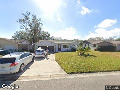
95 Suncrest Dr Safety Harbor, FL 34695
Willowick NeighborhoodEstimated Value: $391,083 - $487,000
--
Bed
2
Baths
2,436
Sq Ft
$184/Sq Ft
Est. Value
About This Home
This home is located at 95 Suncrest Dr, Safety Harbor, FL 34695 and is currently estimated at $448,771, approximately $184 per square foot. 95 Suncrest Dr is a home located in Pinellas County with nearby schools including Safety Harbor Elementary School, Countryside High School, and Safety Harbor Middle School.
Ownership History
Date
Name
Owned For
Owner Type
Purchase Details
Closed on
Sep 12, 2024
Sold by
Stanger Susan E
Bought by
Stanger Susan E and White Kyle
Current Estimated Value
Purchase Details
Closed on
Mar 27, 2001
Sold by
Carland David M and Carland Diane M
Bought by
Stanger Susan
Home Financials for this Owner
Home Financials are based on the most recent Mortgage that was taken out on this home.
Original Mortgage
$149,000
Interest Rate
7.02%
Mortgage Type
New Conventional
Purchase Details
Closed on
Jan 20, 1994
Sold by
Koval Donald and Koval Juanita
Bought by
Carland Diane M and Carland David M
Home Financials for this Owner
Home Financials are based on the most recent Mortgage that was taken out on this home.
Original Mortgage
$83,172
Interest Rate
7.13%
Mortgage Type
FHA
Create a Home Valuation Report for This Property
The Home Valuation Report is an in-depth analysis detailing your home's value as well as a comparison with similar homes in the area
Home Values in the Area
Average Home Value in this Area
Purchase History
| Date | Buyer | Sale Price | Title Company |
|---|---|---|---|
| Stanger Susan E | -- | None Listed On Document | |
| Stanger Susan | $127,000 | -- | |
| Carland Diane M | $83,500 | -- |
Source: Public Records
Mortgage History
| Date | Status | Borrower | Loan Amount |
|---|---|---|---|
| Previous Owner | Stanger Susan | $149,000 | |
| Previous Owner | Carland Diane M | $83,172 |
Source: Public Records
Tax History Compared to Growth
Tax History
| Year | Tax Paid | Tax Assessment Tax Assessment Total Assessment is a certain percentage of the fair market value that is determined by local assessors to be the total taxable value of land and additions on the property. | Land | Improvement |
|---|---|---|---|---|
| 2024 | $1,632 | $139,592 | -- | -- |
| 2023 | $1,632 | $135,526 | $0 | $0 |
| 2022 | $1,573 | $131,579 | $0 | $0 |
| 2021 | $1,582 | $127,747 | $0 | $0 |
| 2020 | $1,573 | $125,983 | $0 | $0 |
| 2019 | $1,536 | $123,151 | $0 | $0 |
| 2018 | $1,508 | $120,855 | $0 | $0 |
| 2017 | $1,489 | $118,369 | $0 | $0 |
| 2016 | $1,470 | $115,934 | $0 | $0 |
| 2015 | $1,501 | $115,128 | $0 | $0 |
| 2014 | $1,490 | $114,214 | $0 | $0 |
Source: Public Records
Map
Nearby Homes
- 140 Meadowlark Dr
- 2195 Glen Dr
- 110 Avon Dr
- 160 Avon Dr
- 145 Avon Dr
- 0 Elm St Unit MFRTB8331367
- 1708 Country Trails Dr
- 1908 Bayshore Ct
- 511 Duxbury Ct Unit C
- 515 Mistletoe Ct Unit C
- 1310 Country Trails Dr
- 0 Irwin St E Unit MFRTB8323374
- 318 Parkside Ln
- 321 Parkside Ln
- 602 Quail Keep Dr
- 612 Fairmont Ave Unit D
- 2364 Flanders Way Unit 41D
- 400 Westborough Ln
- 2363 Newburg Ln Unit B
- 381 Estero Ct