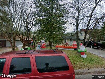
9725 Long Branch Ln Houston, TX 77055
Spring Branch West NeighborhoodEstimated Value: $447,000 - $528,000
2
Beds
3
Baths
2,465
Sq Ft
$198/Sq Ft
Est. Value
About This Home
This home is located at 9725 Long Branch Ln, Houston, TX 77055 and is currently estimated at $487,476, approximately $197 per square foot. 9725 Long Branch Ln is a home located in Harris County with nearby schools including Woodview Elementary School, Spring Branch Middle School, and Spring Woods High School.
Ownership History
Date
Name
Owned For
Owner Type
Purchase Details
Closed on
Nov 20, 1996
Sold by
Weige David Jesse
Bought by
Wheaton John Anson and Wheaton Carina Louise
Current Estimated Value
Home Financials for this Owner
Home Financials are based on the most recent Mortgage that was taken out on this home.
Original Mortgage
$36,600
Interest Rate
7.9%
Mortgage Type
Purchase Money Mortgage
Create a Home Valuation Report for This Property
The Home Valuation Report is an in-depth analysis detailing your home's value as well as a comparison with similar homes in the area
Home Values in the Area
Average Home Value in this Area
Purchase History
| Date | Buyer | Sale Price | Title Company |
|---|---|---|---|
| Wheaton John Anson | -- | Fidelity National Title |
Source: Public Records
Mortgage History
| Date | Status | Borrower | Loan Amount |
|---|---|---|---|
| Open | Wheaton Carina Louise | $180,000 | |
| Closed | Wheaton John Anson | $103,200 | |
| Closed | Wheaton John Anson | $36,600 |
Source: Public Records
Tax History Compared to Growth
Tax History
| Year | Tax Paid | Tax Assessment Tax Assessment Total Assessment is a certain percentage of the fair market value that is determined by local assessors to be the total taxable value of land and additions on the property. | Land | Improvement |
|---|---|---|---|---|
| 2023 | $5,564 | $399,696 | $210,931 | $188,765 |
| 2022 | $9,662 | $398,164 | $184,565 | $213,599 |
| 2021 | $8,796 | $360,283 | $184,565 | $175,718 |
| 2020 | $8,536 | $349,333 | $184,565 | $164,768 |
| 2019 | $8,095 | $297,828 | $166,690 | $131,138 |
| 2018 | $2,979 | $304,400 | $133,352 | $171,048 |
| 2017 | $8,065 | $308,300 | $166,690 | $141,610 |
| 2016 | $7,510 | $308,300 | $166,690 | $141,610 |
| 2015 | $4,842 | $308,300 | $166,690 | $141,610 |
| 2014 | $4,842 | $277,000 | $135,352 | $141,648 |
Source: Public Records
Map
Nearby Homes
- 9705 Pine Lake Dr
- 9713 Larston St
- 1201 Confederate Rd
- 1205 Confederate Rd
- 9633 Larston St
- 9617 Pine Lake Dr
- 1302 Springrock Ln
- 1306 Springrock Ln
- 1305 Confederate Rd
- 9761 Westview Dr
- 1140 Oak Tree Dr
- 9654 Westview Dr Unit 9
- 9650 Westview Dr Unit 11
- 1435 Springrock Ln Unit C
- 9718 Tappenbeck Dr
- 1440 Springrock Ln Unit 4
- 9810 Cedardale Dr
- 1459 Springrock Ln Unit A
- 9829 Larston St
- 1425 Confederate Rd
