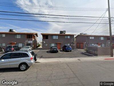
321 N Decatur Blvd Las Vegas, NV 89107
Michael Way NeighborhoodEstimated Value: $666,000 - $685,000
8
Beds
4
Baths
3,172
Sq Ft
$213/Sq Ft
Est. Value
About This Home
This home is located at 321 N Decatur Blvd, Las Vegas, NV 89107 and is currently estimated at $674,333, approximately $212 per square foot. 321 N Decatur Blvd is a home located in Clark County with nearby schools including J.T. McWlliams Elementary School, Robert O Gibson Middle School, and Western High School.
Ownership History
Date
Name
Owned For
Owner Type
Purchase Details
Closed on
Jul 15, 2003
Sold by
Becker Ernest A and Becker Kathleen C
Bought by
Meadows Apartment Properties Llc
Current Estimated Value
Purchase Details
Closed on
Jan 25, 1994
Sold by
Becker Ernest A and Becker Kathleen C
Bought by
Becker Ernest A and Becker Kathleen C
Home Financials for this Owner
Home Financials are based on the most recent Mortgage that was taken out on this home.
Original Mortgage
$23,450
Interest Rate
7.21%
Create a Home Valuation Report for This Property
The Home Valuation Report is an in-depth analysis detailing your home's value as well as a comparison with similar homes in the area
Home Values in the Area
Average Home Value in this Area
Purchase History
| Date | Buyer | Sale Price | Title Company |
|---|---|---|---|
| Meadows Apartment Properties Llc | -- | National Title Company | |
| Becker Ernest A | -- | Nevada Title Company |
Source: Public Records
Mortgage History
| Date | Status | Borrower | Loan Amount |
|---|---|---|---|
| Open | Meadows Apartment Properties Llc | $500,000 | |
| Previous Owner | Becker Ernest A | $23,450 |
Source: Public Records
Tax History Compared to Growth
Tax History
| Year | Tax Paid | Tax Assessment Tax Assessment Total Assessment is a certain percentage of the fair market value that is determined by local assessors to be the total taxable value of land and additions on the property. | Land | Improvement |
|---|---|---|---|---|
| 2025 | $1,708 | $85,911 | $54,950 | $30,961 |
| 2024 | $1,582 | $85,911 | $54,950 | $30,961 |
| 2023 | $1,582 | $77,537 | $50,400 | $27,137 |
| 2022 | $1,466 | $63,710 | $38,500 | $25,210 |
| 2021 | $1,357 | $56,324 | $32,900 | $23,424 |
| 2020 | $1,257 | $52,413 | $29,400 | $23,013 |
| 2019 | $1,178 | $51,733 | $29,400 | $22,333 |
| 2018 | $1,124 | $50,501 | $29,400 | $21,101 |
| 2017 | $1,322 | $40,318 | $19,600 | $20,718 |
| 2016 | $1,054 | $35,720 | $15,400 | $20,320 |
| 2015 | $1,050 | $33,617 | $14,000 | $19,617 |
| 2014 | $1,018 | $30,121 | $11,200 | $18,921 |
Source: Public Records
Map
Nearby Homes
- 424 Stanford St
- 5013 Vermont Ave
- 712 Harvard St
- 604 N Minnesota St
- 617 Stanford St
- 5109 Sugarfoot Ave
- 726 Sea Pines Ln Unit 126
- 5005 Harmony Ave
- 735 Sea Pines Ln
- 5129 Sugarfoot Ave
- 608 Mc Dermit St
- 4420 Saint Andrews Cir
- 124 Countrywood Cir
- 5220 Mission Carmel Ln Unit 101
- 5220 Mission Carmel Ln Unit 103
- 5220 Mission Carmel Ln Unit 107
- 125 Firecreek Cir
- 220 Mission Catalina Ln Unit 207
- 220 Mission Catalina Ln Unit 202
- 1020 Nassau Dr