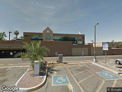
20 E University Dr Tempe, AZ 85281
Downtown Tempe NeighborhoodEstimated Value: $1,491,843
--
Bed
--
Bath
3,600
Sq Ft
$414/Sq Ft
Est. Value
About This Home
This home is located at 20 E University Dr, Tempe, AZ 85281 and is currently estimated at $1,491,843, approximately $414 per square foot. 20 E University Dr is a home located in Maricopa County with nearby schools including Scales Technology Academy, Tempe High School, and New School for the Arts & Academics.
Ownership History
Date
Name
Owned For
Owner Type
Purchase Details
Closed on
Dec 22, 2020
Sold by
Strimling Robert B and Strimling Debra K
Bought by
26 University Tempe Llc
Current Estimated Value
Purchase Details
Closed on
Jul 12, 2006
Sold by
Jung Marc W
Bought by
Strimling Robert B and Strimling Debra K
Home Financials for this Owner
Home Financials are based on the most recent Mortgage that was taken out on this home.
Original Mortgage
$750,000
Interest Rate
6.66%
Mortgage Type
Seller Take Back
Purchase Details
Closed on
May 31, 2005
Sold by
Estate Of Bernard W Jung
Bought by
Jung Marc
Purchase Details
Closed on
May 25, 2005
Sold by
Jung Ted Bernard and Jung Patricia Annette
Bought by
Estate Of Bernard W Jung
Purchase Details
Closed on
Nov 18, 2002
Sold by
Ciancola Robert E
Bought by
Jung Ted Bernard and Jung Patricia Annette
Create a Home Valuation Report for This Property
The Home Valuation Report is an in-depth analysis detailing your home's value as well as a comparison with similar homes in the area
Home Values in the Area
Average Home Value in this Area
Purchase History
| Date | Buyer | Sale Price | Title Company |
|---|---|---|---|
| 26 University Tempe Llc | -- | None Available | |
| Strimling Robert B | $900,000 | Chicago Title Insurance Co | |
| Jung Marc | -- | -- | |
| Estate Of Bernard W Jung | -- | -- | |
| Jung Ted Bernard | -- | -- | |
| Ciancola Robert E | -- | -- |
Source: Public Records
Mortgage History
| Date | Status | Borrower | Loan Amount |
|---|---|---|---|
| Previous Owner | Breof Bnk2 Southwest Llc | $0 | |
| Previous Owner | Strimling Robert B | $750,000 |
Source: Public Records
Tax History Compared to Growth
Tax History
| Year | Tax Paid | Tax Assessment Tax Assessment Total Assessment is a certain percentage of the fair market value that is determined by local assessors to be the total taxable value of land and additions on the property. | Land | Improvement |
|---|---|---|---|---|
| 2025 | $15,924 | $120,950 | -- | -- |
| 2024 | $16,088 | $118,790 | -- | -- |
| 2023 | $16,088 | $155,023 | $101,541 | $53,482 |
| 2022 | $15,740 | $165,288 | $116,025 | $49,263 |
| 2021 | $16,201 | $169,848 | $119,340 | $50,508 |
| 2020 | $15,735 | $157,608 | $107,514 | $50,094 |
| 2019 | $15,423 | $157,176 | $107,514 | $49,662 |
| 2018 | $15,032 | $139,824 | $90,522 | $49,302 |
| 2017 | $14,584 | $138,528 | $83,808 | $54,720 |
| 2016 | $14,455 | $120,240 | $69,840 | $50,400 |
| 2015 | $14,262 | $109,854 | $68,580 | $41,274 |
Source: Public Records
Map
Nearby Homes
- 21 E 6th St Unit 412
- 21 E 6th St Unit 110-112
- 920 S Ash Ave
- 421 W 6th St Unit 1009
- 154 W 5th St Unit 212
- 154 W 5th St Unit 249
- 154 W 5th St Unit 157
- 1109 S Ash Ave
- 1015 S Farmer Ave Unit 5, 6, 7, 8
- 1190 S Maple Ave Unit 1
- 1190 S Maple Ave Unit 2
- 567 W 6th St
- 330 S Farmer Ave Unit 121
- 578 W 6th St
- 625 S Roosevelt St
- 605 S Roosevelt St
- 1224 S Maple Ave
- 520 S Roosevelt St Unit 1009
- 1219 S Farmer Ave
- 14 E 14th St