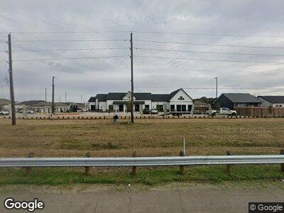
11923 State Highway 6 Fresno, TX 77545
Teal Run NeighborhoodEstimated Value: $513,620
--
Bed
--
Bath
1,764
Sq Ft
$291/Sq Ft
Est. Value
About This Home
This home is located at 11923 State Highway 6, Fresno, TX 77545 and is currently priced at $513,620, approximately $291 per square foot. 11923 State Highway 6 is a home located in Fort Bend County with nearby schools including Walter Moses Burton Elementary School, Lake Olympia Middle School, and Hightower High School.
Ownership History
Date
Name
Owned For
Owner Type
Purchase Details
Closed on
Sep 2, 2022
Sold by
Preserve Hw6 Llc
Bought by
Presrve At Hwy 6 Llc
Current Estimated Value
Home Financials for this Owner
Home Financials are based on the most recent Mortgage that was taken out on this home.
Original Mortgage
$52,236,528
Outstanding Balance
$50,415,092
Interest Rate
5.54%
Mortgage Type
Construction
Purchase Details
Closed on
Feb 17, 2013
Sold by
Divoky Cheron
Bought by
Miranda Christine Etal
Purchase Details
Closed on
Sep 21, 2007
Sold by
Divoky Cheron Etal
Bought by
Miranda Christine Etal
Create a Home Valuation Report for This Property
The Home Valuation Report is an in-depth analysis detailing your home's value as well as a comparison with similar homes in the area
Home Values in the Area
Average Home Value in this Area
Purchase History
| Date | Buyer | Sale Price | Title Company |
|---|---|---|---|
| Presrve At Hwy 6 Llc | -- | -- | |
| Miranda Christine Etal | -- | -- | |
| Miranda Christine Etal | -- | -- |
Source: Public Records
Mortgage History
| Date | Status | Borrower | Loan Amount |
|---|---|---|---|
| Open | Preserve At Hwy 6 Llc | $1,510,000 | |
| Open | Presrve At Hwy 6 Llc | $52,236,528 |
Source: Public Records
Tax History Compared to Growth
Tax History
| Year | Tax Paid | Tax Assessment Tax Assessment Total Assessment is a certain percentage of the fair market value that is determined by local assessors to be the total taxable value of land and additions on the property. | Land | Improvement |
|---|---|---|---|---|
| 2023 | $381,708 | $529,246 | $372,232 | $157,014 |
| 2022 | $3,171 | $376,240 | $372,240 | $4,000 |
| 2021 | $3,366 | $190,950 | $186,120 | $4,830 |
| 2020 | $3,467 | $193,330 | $186,120 | $7,210 |
| 2019 | $3,642 | $193,330 | $186,120 | $7,210 |
| 2018 | $3,607 | $190,950 | $186,120 | $4,830 |
| 2017 | $3,651 | $190,740 | $186,120 | $4,620 |
| 2016 | $3,460 | $190,740 | $186,120 | $4,620 |
| 2015 | $3,478 | $190,450 | $186,120 | $4,330 |
| 2014 | $3,478 | $189,580 | $186,120 | $3,460 |
Source: Public Records
Map
Nearby Homes
- 1100 Rabb Rd
- 1814 Thistlecreek Ct
- 4046 Camelia Glen Ln
- 2403 Shadow Oaks Dr
- 2514 Shadow Oaks Dr
- 1802 Coretta Ct
- 1803 Shadow Haven Ct
- 2035 & 2043 Darby Ln
- 4723 Great Acre Ln
- 2722 Park Oak Ct
- 1719 Blue Heather Ln
- 2603 Border Cove Cir
- 1714 Regal Blue Ct
- 3931 Aerial Brook Trail
- 2218 Steep Pine Tr
- 1703 Regal Blue Ct
- 2643 Westward Hill Dr
- 1619 Regal Blue Ct
- 4603 Biggam Dr
- 4025 Redwood Hill Ct