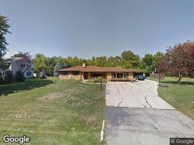
S71W19744 Simandl Dr Muskego, WI 53150
Estimated Value: $347,999 - $359,000
3
Beds
2
Baths
1,608
Sq Ft
$219/Sq Ft
Est. Value
About This Home
This home is located at S71W19744 Simandl Dr, Muskego, WI 53150 and is currently estimated at $352,000, approximately $218 per square foot. S71W19744 Simandl Dr is a home located in Waukesha County with nearby schools including Mill Valley Elementary School, Muskego Lakes Middle School, and Muskego High School.
Ownership History
Date
Name
Owned For
Owner Type
Purchase Details
Closed on
Nov 29, 2021
Sold by
Thomka Trust
Bought by
Stonehouse Property Group Llc
Current Estimated Value
Purchase Details
Closed on
Nov 15, 2021
Sold by
Waukesha County
Bought by
Thomka William and Thomka Mary Ann
Purchase Details
Closed on
Oct 7, 2015
Sold by
Thomka Mary Ann
Bought by
Mary Ann Thomka Trust
Create a Home Valuation Report for This Property
The Home Valuation Report is an in-depth analysis detailing your home's value as well as a comparison with similar homes in the area
Home Values in the Area
Average Home Value in this Area
Purchase History
| Date | Buyer | Sale Price | Title Company |
|---|---|---|---|
| Stonehouse Property Group Llc | $264,200 | 1St Service Title | |
| Thomka William | $525 | 1St Service Title | |
| Mary Ann Thomka Trust | -- | None Available |
Source: Public Records
Mortgage History
| Date | Status | Borrower | Loan Amount |
|---|---|---|---|
| Previous Owner | Thomka Mary Ann | $22,500 | |
| Previous Owner | Thomka Mary Ann | $117,000 | |
| Previous Owner | Thomka William T | $121,700 | |
| Previous Owner | Thomka William T | $121,800 |
Source: Public Records
Tax History Compared to Growth
Tax History
| Year | Tax Paid | Tax Assessment Tax Assessment Total Assessment is a certain percentage of the fair market value that is determined by local assessors to be the total taxable value of land and additions on the property. | Land | Improvement |
|---|---|---|---|---|
| 2024 | $2,960 | $264,200 | $70,600 | $193,600 |
| 2023 | $2,914 | $264,200 | $70,600 | $193,600 |
| 2022 | $2,851 | $264,200 | $70,600 | $193,600 |
| 2021 | $2,822 | $264,200 | $70,600 | $193,600 |
| 2020 | $3,161 | $230,600 | $61,700 | $168,900 |
| 2019 | $3,130 | $230,600 | $61,700 | $168,900 |
| 2018 | $3,169 | $230,600 | $61,700 | $168,900 |
| 2017 | $3,764 | $230,600 | $61,700 | $168,900 |
| 2016 | $3,184 | $206,200 | $59,200 | $147,000 |
| 2015 | $3,220 | $206,200 | $59,200 | $147,000 |
| 2014 | $3,505 | $206,200 | $59,200 | $147,000 |
| 2013 | $3,505 | $206,200 | $59,200 | $147,000 |
Source: Public Records
Map
Nearby Homes
- W194S7343 Richdorf Dr
- W192S7180 Hillside Dr
- Lt2 Racine Ave
- W191S7367 Shore Ln
- S75W19390 Woodland Place
- S70W18778 Gold Dr
- S77W19744 Sanctuary Dr
- W188S7598 Oak Grove Dr
- W194S7764 Overlook Bay Rd Unit A
- W193S7842 Overlook Bay Rd Unit 7F
- W193S7927 Ancient Oaks Dr
- S77W18512 Janesville Rd
- S77W18401 Kelly Dr
- 6290 S Martin Rd
- W179S6666 Ranch Dr
- W177S7495 Harbor Cir Unit 6D
- S76W17745 Janesville Rd
- S75W17553 Harbor Cir Unit 1B
- 5920 S Racine Ave Unit Lt2
- W176S7774 Kristin Dr